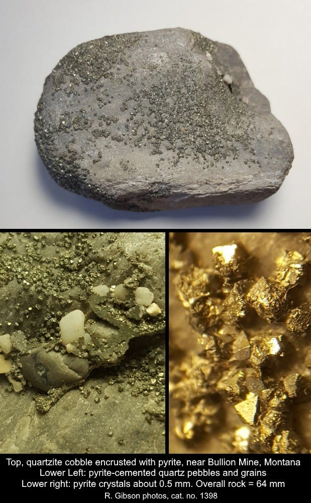
This rock is just a piece of nicely rounded gray quartzite, with a crust of pyrite crystals on it. That wouldn’t be too special, but I’m essentially certain that the pyrite crystallized there probably within the past 100 years.
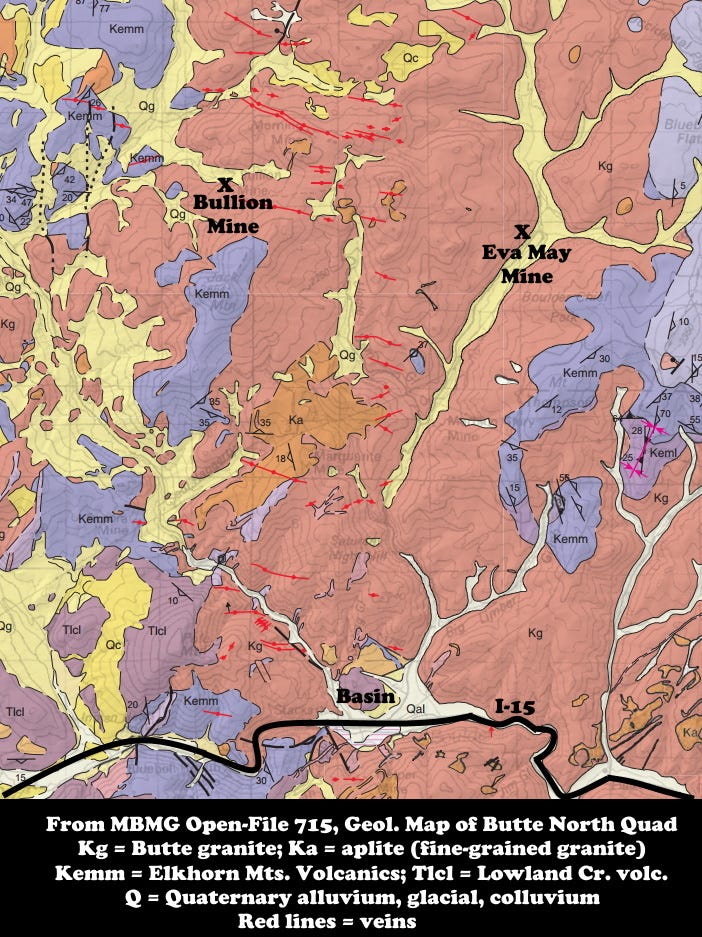
The rock is probably from a quartz vein in the Butte Granite of the Boulder Batholith which solidified about 76 million years ago. I picked it up in a tributary of Jack Creek (probably the mine adit discharge channel, but I don’t really recall exactly where I found it), near the Bullion Mine north of Basin, Montana, sometime in the early 1990s. That tributary was an extreme example of acid mine drainage; as I recall, the pH (acidity) of the water was around 1.0 (very acid) and it was bright orange-red in color from dissolved iron.
I think the pyrite is very young because the rock is so well rounded – it had to be a pebble/cobble from the stream, and the stream has likely been there at most around 12,000 years, beginning when the last glacial age ended (yes, conceivably it formed in a pre-glacial stream, but I bet it didn’t). And there are even small bits of additional rock delicately cemented by pyrite to the big one. I suspect that the pyrite (iron sulfide) precipitated out of the highly acid, high-iron water sometime after the mining pulverized enough rock to expedite the iron sulfide-water reaction that made the sulfuric acid mine drainage.
Gold mining here started perhaps as long ago as the 1880s, but the Bullion Mine was reactivated in a big way beginning about 1905 when a new concentrator opened at the Eva May Mine a few miles away. It was one of many small gold mines in the area – small, but for a time, the Bullion mine paid $17,000 in wages in just one month.
The Bullion and Eva May Mines were both in vein systems in the Butte Granite, part of the Boulder Batholith, intruded about 76 million years ago as a consequence of subduction along the western margin of North America.
The Bullion Mine was idle by 1933 but saw occasional attempts to rejuvenate it over time, into the 1960s. Since I was there in the early 1990s, it has been extensively remediated (2001-2002) to address heavy metal contamination. A study a year later found some problems reduced, but others including acid water remaining. In 2014-15, dewatering and other actions began to address the acid mine drainage issues. Monitoring and analysis are ongoing, and the Bullion Mine is an Operable Unit within the Basin Mining Area Superfund Site, which was added to the National Priorities Superfund list in 1999.
If I’m correct that the pyrite on the rock is less than 100 years old, that gives you a sense of how fast it is possible for mineralization to take place, albeit enhanced by the human activity. I’d be happy to be wrong, but I’ll be surprised to learn that the creek there had the proper chemical conditions to precipitate pyrite before the mining disturbed the material and created the vastly greater surface area for reactions to occur.
That’s why you don’t find many extremely acidic natural surface waters even near major sulfide ore deposits: it’s the exposure of so much broken and pulverized rock to water by human activities that leads to acid mine drainage. Iron sulfide (pyrite) is common and reacts with water to dissolve and form other (soluble) iron compounds plus sulfuric acid, but it does that much more efficiently when it’s broken into small pieces.
And sometimes, as I speculate for this rock, the reaction goes the other way and pyrite precipitates. The reactions are complex and depend on, for example, temperature as well as the concentrations of iron and sulfur and (probably) trace elements and the presence or absence of buffering agents like limestone, and the presence or absence of extremophile organisms.
Individual pyrite crystals here are about a half millimeter across. The whole rock is 64 mm long, which puts it right at the conventional break between grain sizes considered to be pebbles (smaller) or cobbles (larger than 64 mm). Cat. No. 1398.


I wonder if these small pyrite crystals would show some kind of zoning if they were sliced and polished. Zoning might reflect variations in acidity or some of the other factors you mention.
Cheers!
Very cool Richard. Funny, just today (and other days) I was walking a gravel road away from the beach, and the gravel road is lined with cobbles and boulders here on Palawan. Not sure why, since the road itself was cobbles and larger rocks, rough and uneven. But it made me wonder how long have these rocks, on this level area, been here? Hundreds of years, if not thousands for the tougher ones? This is not on the 'ring of fire', so it's "boring" here no dramatic events to alter rocks. It doesn't flood with strong current, there's only weathering. So you mention you figure the creek (er, crik(!) was there 12K years. (IF this island moves 4cm/yr, guessing an average drift, in that time it's moved 1500+ feet. But not much else has changed.) They are mostly all well rounded from slow weathering, and these rocks are tough, not like the crumbling hillsides of serpentine around here. (So after all that rambling,) my question: Could it be calculated how long these rocks have been here?
I don't need an answer, a ballpark figure or even some ideas would suffice.
Any thoughts?
Thanks.
Mike