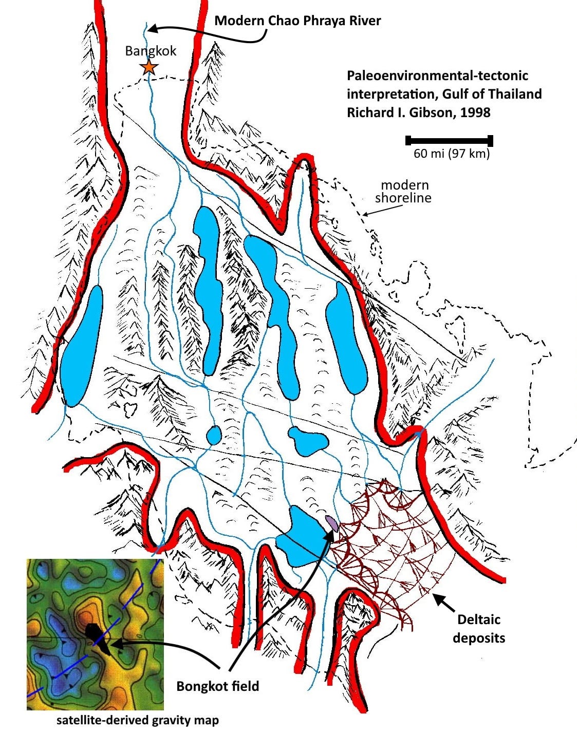
This map shows the kind of thing I’d try to produce when I interpreted gravity and magnetic data for hydrocarbon exploration. The area is the Gulf of Thailand, a relatively shallow sea area with a flat water bottom. That means that most of the variations in the gravity field are the result of subsurface geology.
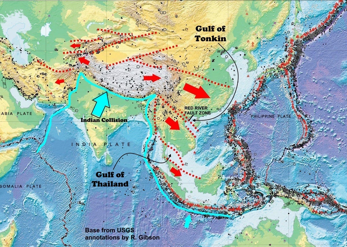
During the early to middle Tertiary, Eocene to Miocene time, about 40 to 20 million years ago, India was beginning its aggressive push into the underbelly of Eurasia. One consequence of that collision is that areas to the southeast, Myanmar, Thailand, and Indochina today together with their offshore extensions, were pushed and squeezed to make way for the collision. A lot of country was literally extruded from its original location to the northwest, and now occupies southeast Asia, including the Gulf of Thailand.
Much of the material that was pushed to the southeast by the India collision consists of long linear strips of geological terranes, typically bounded by complex fault zones (technically, I think the faults here are mostly transtensional in nature, meaning they have components of strike-slip sliding as well as pulling apart).
The map above shows the "extrusion" of Southeast Asia and other areas (red arrows) as a consequence of the collision of India with Eurasia (blue arrow). The linear river valleys, hilly areas, and lakes I show in the map at top would follow linear fault zones that result from this “extrusion.”
The squeezing and pushing means that along those faults, some segments go up and some go down, and that is the heart of this interpretation – that low-lying areas (similar to the basins in Nevada today) trapped sediments eroded off the adjacent highlands. In fact, many of the low-lying areas held lakes over much of the early to middle Tertiary, and lakes often capture some of the most organic-rich sediments on earth. Those organic-rich sediments became source rocks for oil and gas fields.
Bongkot gas field is one of the largest in this offshore region. It was discovered in 1973, and at times since production began in 1993 Bongkot and nearby Erawan field provided as much as 70% of the natural gas needs for all of Thailand. The gas is trapped in multiple sandstones deposited by rivers and in deltas, draining through the complex river-lake-upland system portrayed here in my interpretation. Furthermore, the field is in a gentle uplift that is indicated by the gravity high (red colors) in the inset at lower left. That means it’s possible to identify analogs to this setting, where similar oil or gas fields might be found. It was my job to try to figure that out. This was a small part of a multi-year project on all the offshore areas of Southeast Asia and Indonesia.
Even though Bongkot field is 180 km offshore, the water depth is only about 80 meters.
The Gulf of Thailand covers an area larger than the state of Nevada.
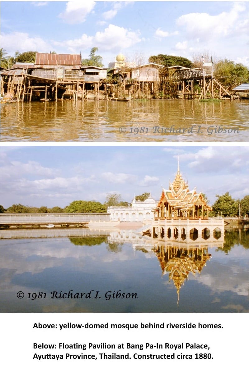
The 1981 photos above are from a jet-boat ride on the Chao Phraya river north of Bangkok. The Chao Phraya is the major river at the head of the paleo-river-lake system inferred to have occupied the Gulf of Thailand when it was above sea level, 40 to 20 million years ago. The Chao Phraya flows through Bangkok on the map at top, so its location is also guided by the tectonic features created by the collision of India.
Chao Phraya is usually translated as “river of kings.” Bongkot is Thai for “lotus.”


