


Life in the USA is not normal. It feels pointless and trivial to be talking about small looks at the fascinating natural world when the country is being dismantled. But these posts will continue, as a statement of resistance. I hope you continue to enjoy and learn from them. Stand Up For Science!
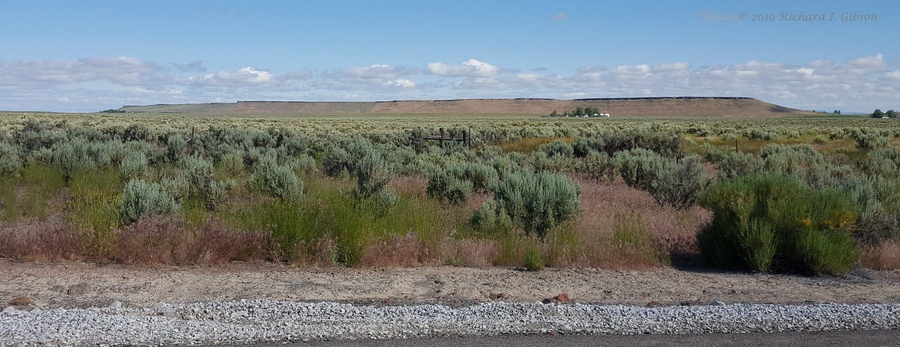
You might think this distant view shows the edge of a mesa, the erosional edge of a flat-topped plateau-like feature capped by some resistant rock. But when you drive over it (yes, the road goes right over it) you find that it is really narrow.
Oregon Highway 205 south from Burns toward Malheur Wildlife Refuge crosses Wrights Point, which rises about 250 feet above the plain and is eight miles long, but it’s only about a half mile wide. And it is indeed a resistant basalt flow.
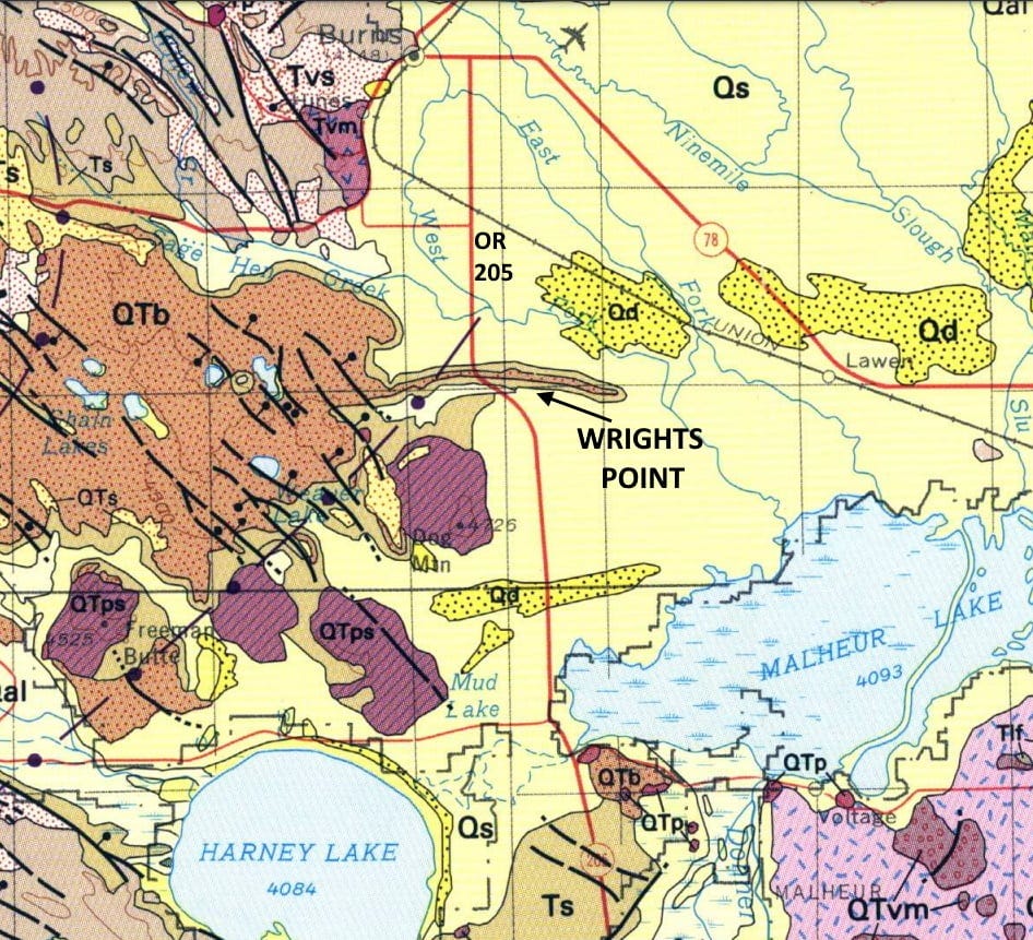
You can see from the geologic map (Geologic Map of Oregon, Walker and McLeod, 1991, USGS) that it is a long narrow extension from a much larger area of basalt (the red patterned area labeled QTb on the map). According to Marli Miller (2014, Roadside Geology of Oregon) these basalt flows are Pliocene, between 5.33 and 2.58 million years old, just yesterday geologically.
From the volcanic center, the blobby area of QTb at left-center on the map, lava flowed down a river valley to the east. No surprise there: lava flows like water, under gravity into the lowest points available, following paths of least resistance, in this case a narrow, slightly arcuate east-trending valley. But where is that river valley now?
Erosion removed the higher but softer sediments that defined the flanks of the narrow river valley (and all those rocks for miles around, creating the flat plain), leaving behind the resistant lava that filled it. This situation is called inverted topography, where a position that was once low-lying is now high-standing (but not through faulting or other tectonic activity, only by erosion), and this is a classic and excellent example of an inverted topographic landform. It represents a valley, now gone, that you have to go up to get across.
The tectonic origin of the young volcanics (some more recent than 10,000 years ago) in eastern Oregon is not clear to me, so if someone knows more, please chime in. Most of the Columbia Plateau Basalt flows had ceased by about 6 million years ago, and this seems a bit distant to be closely related to the modern volcanism in the Cascades (but that Cascade subduction volcanism and basin-and-range faulting is still my best guess). The contemporary volcanics related to the Yellowstone Hot Spot and Snake River Plain are also far away (in Yellowstone and in the Newberry Volcano area).
This inverted topography probably also indicates some changes in climate. It was probably considerably wetter in the time soon after the volcanic basalt flow happened so that all the erosion of surrounding rock could occur. Erosion is of course still happening, but in arid country as we find here today, it happens much more slowly.
Photo from 2019.
Thank you, that's just interesting, never thought about how that could occur. It's worth seeing a satellite view of this from the various online maps. I found this mention of Wright's Point on a website, "Eastern Oregon Online" as well. https://spot.pcc.edu/~mhutson/mjames/wpoint.html
Another good example is North and South Table Mountains in the Golden Colorado area. The approx 64 Ma basalt flows (shoshonite) from a vent(s) up Ralson Creek overlying and interfingering with the Denver Formation. Neogene uplift induced erosion (especially Clear Creek) has separated the flows into North and South Table Mountains.