


Life in the USA is not normal. It feels pointless and trivial to be talking about small looks at the fascinating natural world when the country is being dismantled. But these posts will continue, as a statement of resistance. I hope you continue to enjoy and learn from them. Stand Up For Science!
The Lander Anticline and the oil field it contains in central Wyoming are the expressions of a deep-seated break in the ancient core of the Wyoming Craton. The rocks on the surface are mostly the Triassic Chugwater (red beds) and Jurassic Nugget Formation (sandstone) that have been arched up into the anticline because of a thrust fault on the eastern flank of the Wind River Mountains.
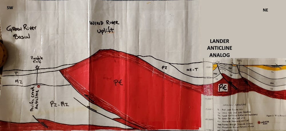
That’s a relatively small fault, an analog to the much larger Wind River Fault on the west side of the Wind River Mountains. In the cross section, red represents the crystalline Precambrian basement rocks, mostly Archaean in age (more than 2.5 billion years old). In the Wind Rivers, the Precambrian core reaches the surface (to the top of the range at nearly 14,000 feet (4300 m) above sea level) but at the position of the Lander Anticline it remains in the subsurface but has pushed the overlying rocks into an arch-like geometry. The far-right side of the cross section is from Ray & Keefer (1985, Wind River Basin: Rocky Mountain Association of Geologists, Seismic Exploration of the Rocky Mountain Region).
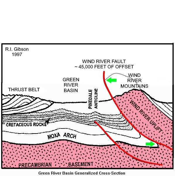
The offset on the Wind River Fault itself is on the order of 45,000 feet (13,700 m) on the west (Green River Basin) side.
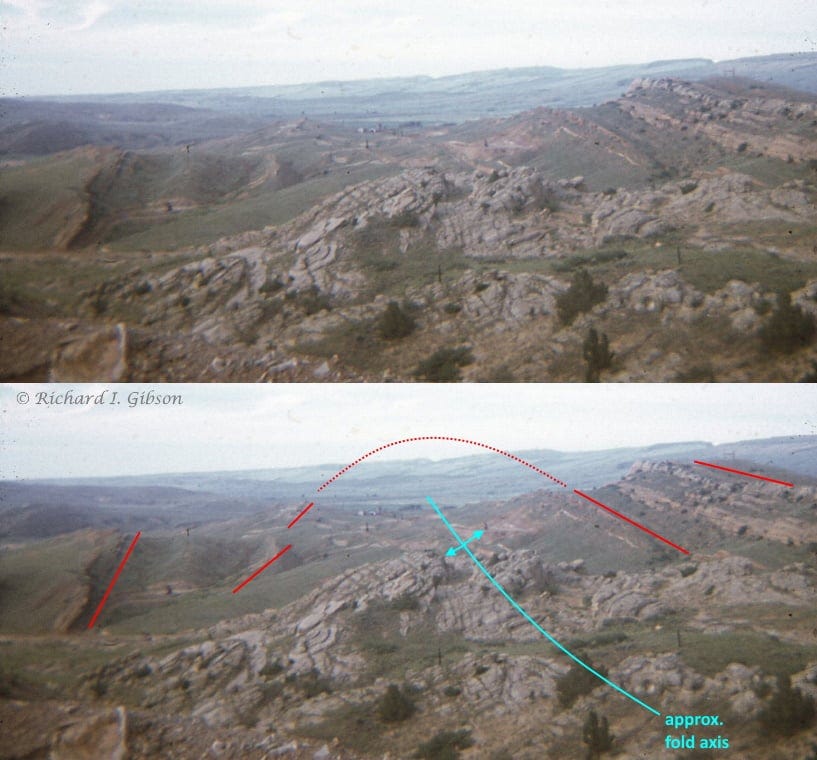
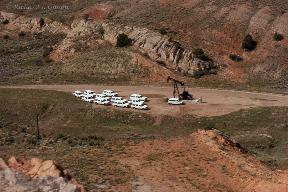
You can see the opposite-dipping layers (annotated as red lines) of Chugwater and Nugget in the photo looking along the axis of the fold. The fold is not well expressed in the near foreground of the photo because the Nugget formation there is not very well layered. The pump-jack near the vehicles in the top photo is near that axis, which marks the highest part of the oil field in the subsurface. The prominent outcrop beyond the vehicles and pump-jack is in the Nugget formation, dipping away from us to the southwest, while at the lower left corner of the photo, similar rocks dip back toward us, defining the anticline axis between them.
Oil was discovered in this area in the 1880s based on surface seepages and the obvious anticlinal structure. Many of the early wells found oil in the Permian Phosphoria Formation just below the Triassic Chugwater at depths ranging from 300 to 1100 feet (90 to 340 m), with a few producing from the somewhat deeper Pennsylvanian Tensleep Formation. Although the wells never produced much oil on a daily basis, they produced steadily, and cumulative production from the Lander Field is something like 12 million barrels.
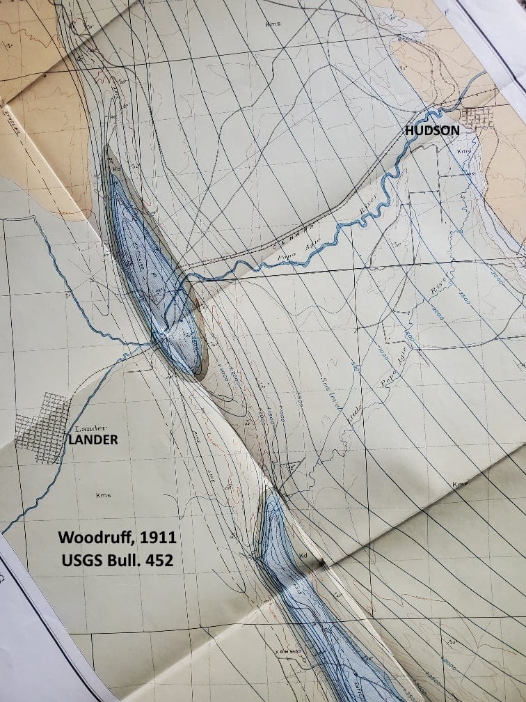
The map above from Woodruff (1911, USGS Bull. 452) shows the tear-drop plan of the Lander Anticline, transected by the Popo Agie River (pronounced po-POH-zha; a Crow name usually translated as “gurgling river”). The anticline is part of a string of similar anticlines that all reflect the basement-cored thrust fault on the flank of the Wind Rivers.
Hang in there!
Thank you for this post! It brought back fond memories of my field camp with Univ of Mo at the Branson Field Laboratory. One of the first exercises was in the area of Dallas and Derby domes (I believe those are the correct names. It was way back last century).