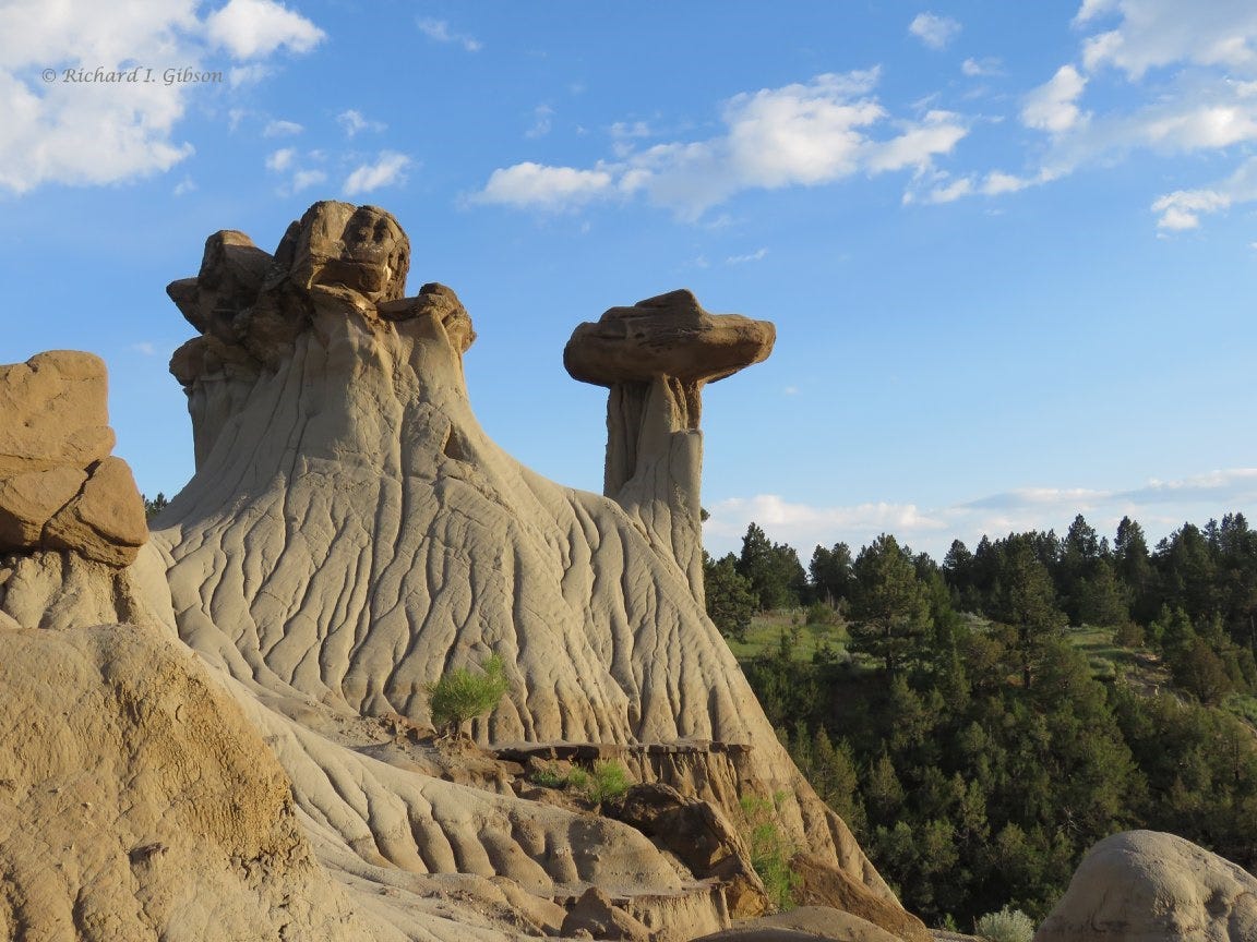
Makoshika State Park, near Glendive, Montana USA, is renowned for its fanciful and beautiful erosional features, as well as for preserving evidence of the Cretaceous-Tertiary (K-T, or if you prefer, Cretaceous-Paleogene, K-Pg; “K” is the geological symbol for Cretaceous) extinction event. But the rocks are present in the subsurface across much of eastern Montana. Why are they so dramatically exposed (and eroded) at Makoshika?
The answer lies deep in the subsurface.
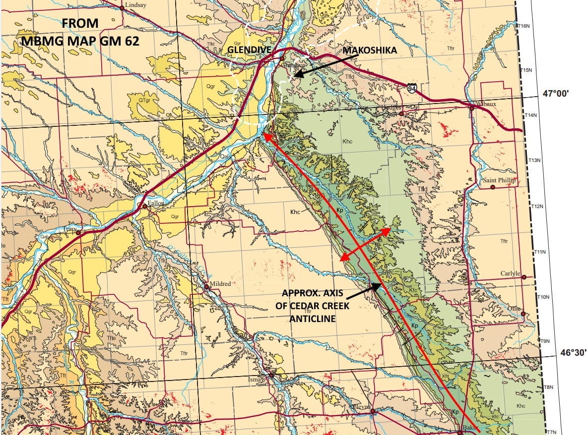
Makoshika is near the northern end of the Cedar Creek Anticline, an up-arched fold that’s the largest geological structure at the surface in eastern Montana, more than 120 miles long. It brings older rocks up along its axis, with younger rocks on each flank. On the map above (from the Montana Bureau of Mines & Geology Geologic Map of Montana), the oldest layers are “Kp,” the Cretaceous Pierre Shale, with younger Fox Hills formation (Kftt, Kfc) on both sides, then a wide area of youngest Cretaceous Hell Creek Formation (Khc, light green, about 66-68 million years old) that makes up most of the rocks at Makoshika, but some younger Fort Union Formation (Tfld, buff color) is there too.
The sharp linear southwestern edge of the anticline (with narrow outcrop belts) and the wider outcrop patterns on the northeastern flank tell us the Cedar Creek Anticline is asymmetrical, with the southwestern side much steeper than the northeastern. Makoshika sits on the northeastern, nearly flat flank of the anticline.
Aeromagnetic data give us information about the geometry and mineralogy of magnetic rocks, which in practice usually means those with magnetite in them, which in turn usually means crystalline igneous or metamorphic rocks, which underlie the thick pile of sedimentary rocks in eastern Montana. Generally, such rocks (which we call the “basement”) are around 10,300 feet (3,140 meters) below the surface near Makoshika. The basement rocks here are very old, at least 1,800 million years and perhaps much older, while the surface Cretaceous rocks are only about 65 to 80 million years old.
What we see in the magnetic map is a long linear gradient right along the southwestern flank of the Cedar Creek Anticline, the slope between a magnetic high (green) to the southwest and a magnetic low (blue) to the northeast. That means the basement rocks within the anticline are considerably less magnetic than those to the southwest, enough to indicate two different rock types, as different as say, metamorphosed granite (light colored, siliceous, not much iron) and metamorphosed andesite (darker, richer in iron and magnesium, more magnetite). Relatively intense high-low features in magnetic data fundamentally indicate rock-type contacts, but such contacts often are weaker zones that can be exploited by faulting during tectonic activity.
That basement rock-type contact expressed in the magnetic data was indeed activated as a fault at various times in the past 1,800 million years, but the one that formed the Cedar Creek Anticline is quite young. Because the Cretaceous rocks are involved in the fold (and some of the overlying Tertiary rocks are too), we know the Cedar Creek Anticline was forming as recently as about 55 to 65 million years ago. That’s the time of the Laramide-Sevier Orogeny, ultimately caused by subduction and collisions between North America and various terranes to the west, largely in what is now Idaho and Washington – but the stresses were transmitted all the way to eastern Montana, and to the Black Hills in South Dakota.
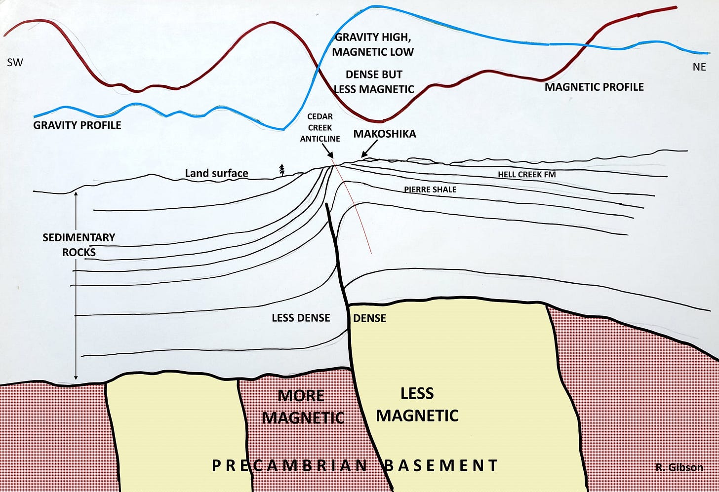
The fault that underlies the southwestern flank of the Cedar Creek Anticline broke during the Laramide-Sevier Orogeny, lifting up the northeast side and dropping down the southwest side, and draping the overlying sedimentary rocks to produce the Anticline. It may seem counterintuitive that on the magnetic map, the anticline, the uplifted side, is a magnetic low, and the downdropped side is a magnetic high, but remember, the magnetic map is mostly telling us about the two basement rock types on either side of the fault, not their position up or down. For that information, we turn to gravity data.
Gravity data basically indicate the contrasts between denser rocks and less dense rocks. Generally (but not always), rocks at greater depths are denser than shallower rocks simply because they have been buried longer and deeper and were under more pressure compressing them, more so than shallower rocks. Consequently, things like anticlines usually are marked by gravity highs because denser rocks have been brought up to anomalously shallower depth, and that’s what we find at Cedar Creek. Also generally, the crystalline basement rocks are often denser than sedimentary rocks.
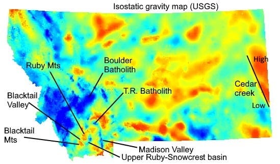
So there’s a gravity high coinciding with the Anticline (and the uplifted dense basement), and with a magnetic low, which just means the rocks in the depths of the anticline are denser but less magnetic than those to the southwest. On the gravity map, the Cedar Creek anticline is red (gravity high) and the side southwest of the basement fault is blue and green (gravity low).
The cross-section above is a cartoon in which I try to show those relationships, as well as the draped sedimentary rock layers that crop out at Makoshika where they were eroded into the beautiful features we see there. The erosion is mostly from the past two million years or more recently, and much of it may be since the end of continental glaciation in the area just 12,000 to 20,000 years ago. The hoodoos and other forms are present at the surface, and were therefore eroded, because of tectonic activity 10,000 feet down that affects both the crystalline basement and the overlying sedimentary rocks. Purists, please don’t yell at me, it’s a cartoon, not a balanced cross-section!!
Makoshika is a variant spelling of a Lakota phrase that means bad land or bad earth. The photos are from 2017.


Great explanation. I'm often confused by gravity vs magnetic highs and lows and how to interpret them.