
Moraines
Defining old glacial positions

Life in the USA is not normal. It feels pointless and trivial to be talking about small looks at the fascinating natural world when the country is being dismantled. But these posts have been scheduled for over a month, and they will continue, as a statement of resistance. I hope you continue to enjoy and learn from them.
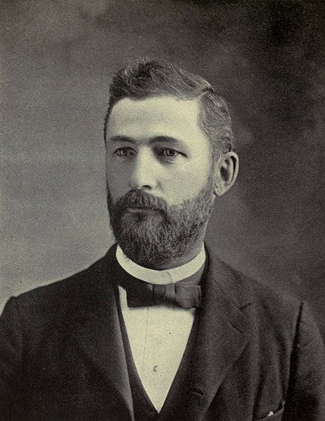
In his memorial to Frank Leverett (1859-1943), William H. Hobbs called him “The greatest American glacial geologist of our generation and one of the greatest of all time.”
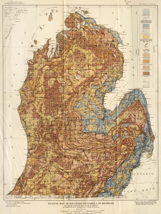
Although Leverett did some work on other areas, he is most noted for his comprehensive work on the glacial deposits around the Great Lakes. The map above is of moraines and other deposits in the Lower Peninsula of Michigan, in his 1915 USGS Monograph (No. 53) with Frank Taylor, The Pleistocene of Indiana and Michigan and the History of the Great Lakes. That massive work, with 529 pages and 32 plates, still serves as the basic underpinning for the glacial story of the Great Lakes.
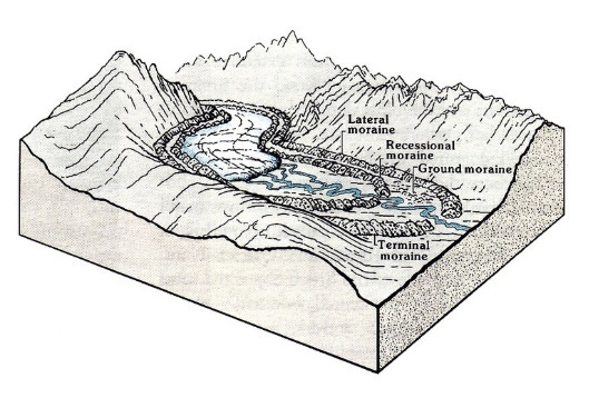
A moraine is a deposit of glacier-borne material dropped by the glacier when it melts. Even though they are often ridges, don’t think of it as a plowed-up pile, but rather as an example of a glacier flowing outwards but continuously melting at a rate that keeps pace with its flow. It just keeps losing the rocks and soil and debris from the melting ice, creating a pile at that stagnant terminus of the glacier – a terminal moraine. You get more than one terminal moraine because the position of that stagnant terminus was at different positions at different times. Glaciers don’t back up; when they “retreat” they just melt faster than they advance.
There are other kinds of moraines, but most of the brown and yellow shades on the map at the top are probably terminal moraines (map from Leverett and Taylor, the 1915 Monograph mentioned above; my copy was withdrawn from the library of the Yellowstone Bighorn Research Association near Red Lodge, Montana, the oldest permanent geologic field station in the US still in operation). You can see how closely they mimic the modern shoreline, especially of Saginaw Bay, the inlet that helps create lower Michigan’s famous “mitten” shape. The blue colors on the map are lake deposits, from times when Lake Huron (on the east side of the Lower Peninsula) was more extensive than it is today.
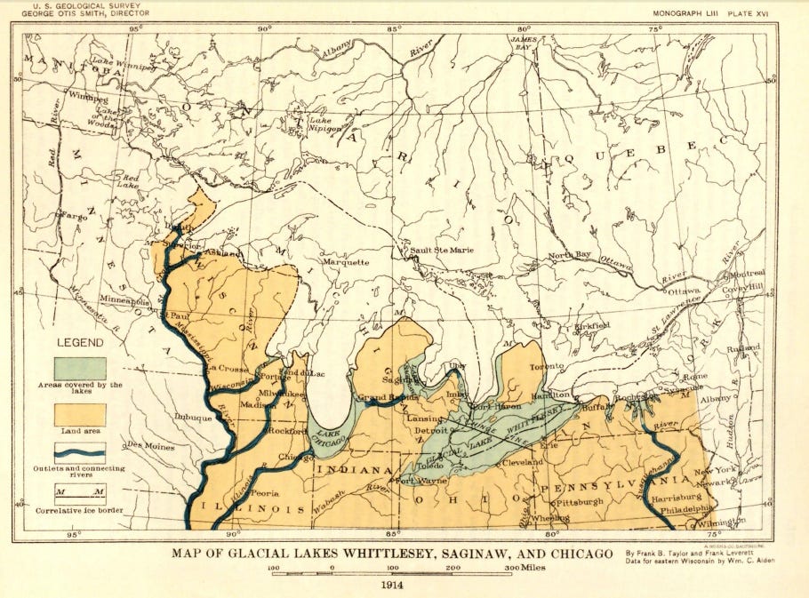
Using their mapping of surficial material and its geometry, including especially moraines, Leverett and Taylor defined the evolution of the Great Lakes as the ice front retreated. The Lake Whittlesey Stage in the map above was named for the dominance of a glacial lake that occupied extensive parts of northern Ohio and southeastern Michigan, of which Lake Erie is a much smaller remnant today. Lake Whittlesey and associated Lake Saginaw and Lake Chicago (in what is now southern Lake Michigan) were present about 14,000 years ago.
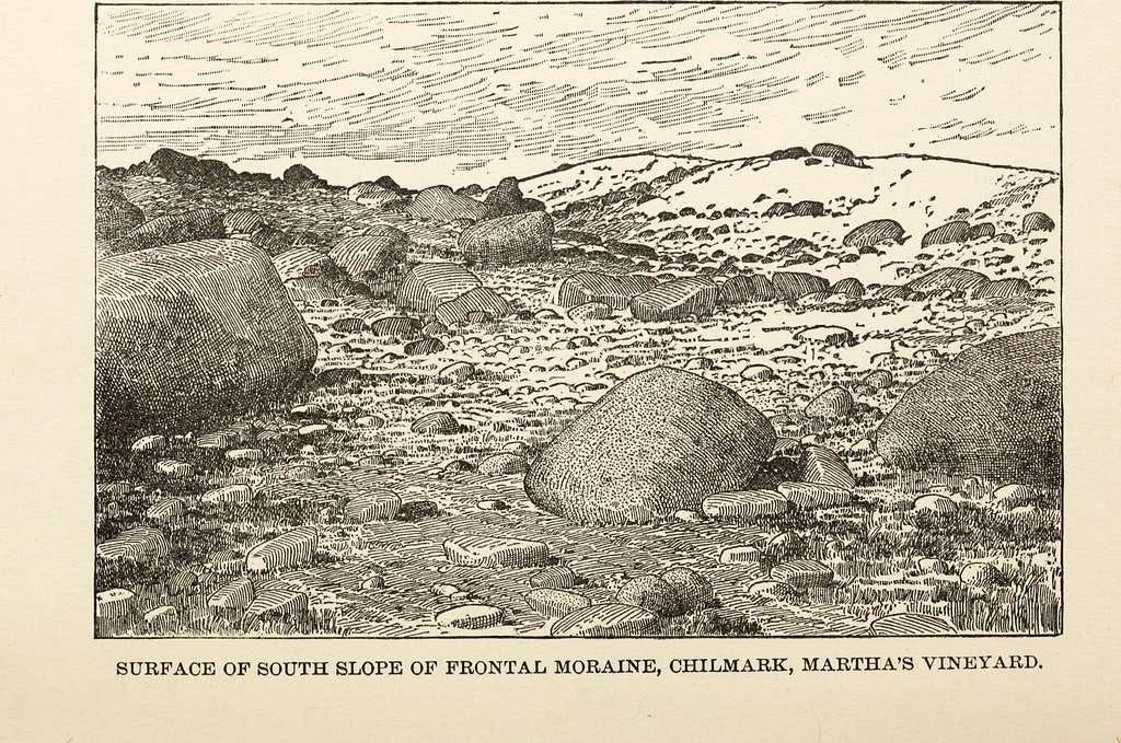
The word moraine is French, from Italian for “mound of earth” and ultimately from Latin for “rounded object.” It has been used in geology and glaciology since 1789. The material in a moraine is also called sometimes called ‘moraine,’ but more usually it is a geomorphic feature composed of glacial till. Glacial till is unconsolidated (if it is lithified, we’d call it tillite; such rocks are known from glacial periods much older than the recent one) and usually unstratified and unsorted.
Stratified means arranged in nice layers, such as we’d find as the result of winnowing action by flowing water in rivers, waves, and currents, and sorting means the materials – clay, silt, sand, pebbles, boulders – have been separated into their individual fractions by the same winnowing action. A melting glacier does not do that, so the pile of material is just whatever diverse stuff was trapped in the ice and dumped when it melted. Moraine material ranges in size from huge boulders down to sand and clay, mixed together with virtually no organization.
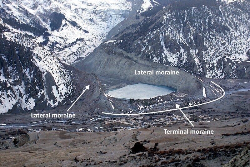
The rock and other debris in glacial ice is also called ‘moraine,’ even before the glacier melts, and it is usually named according to its position in the glacier: lateral moraines are along the sides; medial moraines are in the middle (often marking the join between two separate glaciers upstream). When glaciers melt, that material produces geomorphic features also called lateral and medial moraines, distinct from the terminal moraines described above. And there are other kinds of moraines too; melting glaciers have lots of diverse consequences.
Frank Leverett has glaciers in Antarctica and Greenland named for him, as well as a former lake in Washington and an extinct plant, Sigillaria leveretti.