Mt Hosmer
A classic klippe
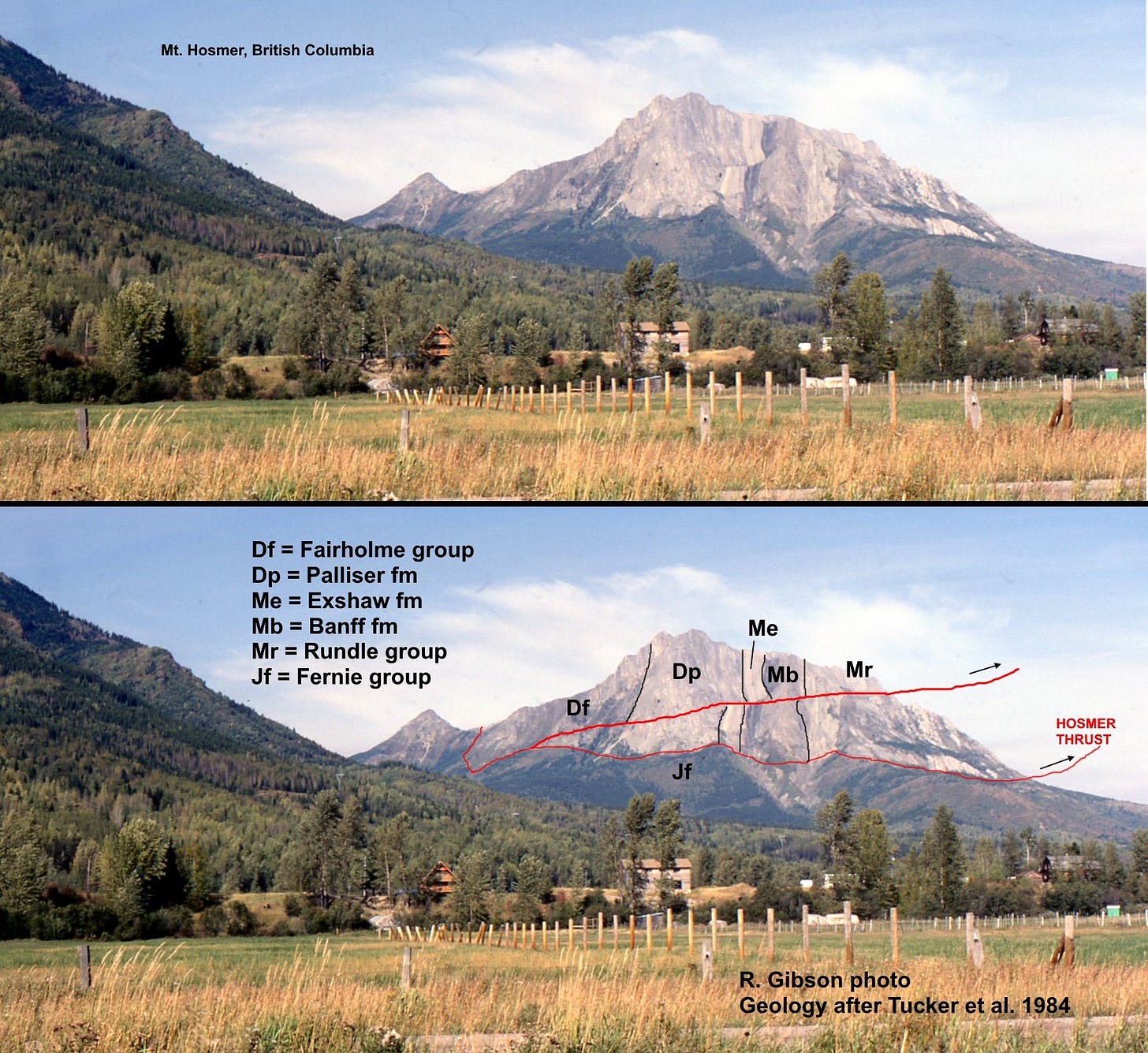
This is Mt. Hosmer, just north of Fernie, British Columbia, Canada. It’s a klippe, an isolated package of rocks in the upper plate of a thrust sheet eroded so that the trace of the fault completely surrounds the mountain. It’s similar to Chief Mountain in Glacier National Park (Montana USA), but the rocks here are younger. Above the fault(s) the near-vertical strata get younger from left (in the Devonian, D, about 365 million years old) to right (in the Mississippian [Lower Carboniferous], M, 330 million), and they are all pushed over the much younger Jurassic (J, 190-160 million) shales in the Fernie Group.
A thrust fault is a low-angle variety of a reverse fault, in which older rocks are pushed (sometimes over great distances, many kilometers) over younger rocks. The Hosmer Thrust Fault represents on the order of 20 km (13 miles) of horizontal displacement (Benvenuto and Price, 1979, Structural evolution of the Hosmer thrust sheet, southeastern British Columbia: Bull. Canadian Petroleum Geol., v. 27, no. 3, p. 360-394).
The Exshaw, Banff, and Rundle formations are more or less the equivalents of the Madison Group in Montana – thick limestones that represent a huge shallow sea that covered much of interior North America about 330 million years ago. The thrust faulting that juxtaposes those rocks over the much younger Jurassic shales occurred about 60 to 75 million years ago, part of the Sevier-Laramide Orogeny.

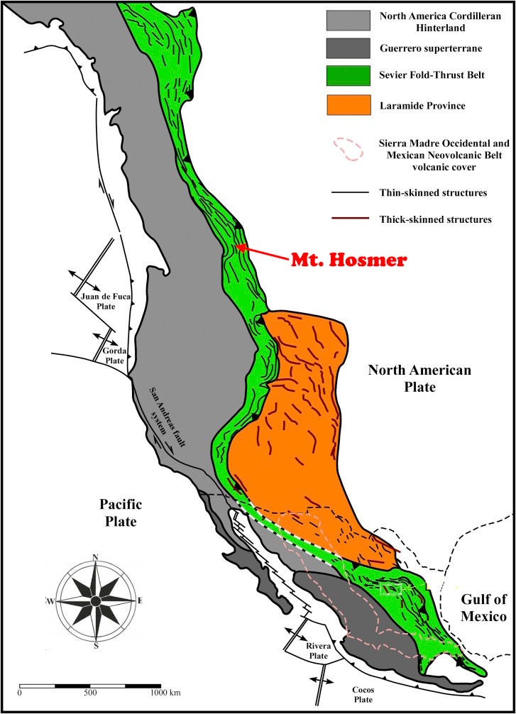
This system of thrust faults extends from Alaska to Mexico, representing collisions along the western margin of North America for more than 15 million years, perhaps as much as 40 million years or more, with the timing varying along the length.
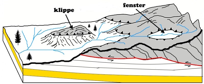
“Klippe” is German for cliff or crag, related to Swedish for cut or clip. A klippe develops when erosion cuts down into a low-angle thrust sheet, isolating part of it and the rocks it carries. The opposite feature, a fenster (“window” in German) is a place where erosion has cut through the low-angle surface of the thrust sheet, but also in an isolated location where the sheet has not eroded away enough to connect that location to the outer eroded edge of the thrust fault. It’s really just the interaction of topography with a relatively flat, relatively horizontal position. The faulting happened fairly deep in the subsurface, so don’t think of it as a push of rocks across the old land surface. The present configuration is the result of erosion of thousands of feet of rocks.
In the cartoon above, the thrusted material (gray) has been pushed to the left along the thrust fault (red in the cross-section face of the drawing, black with triangular teeth on the land surface part of the drawing).
A short way down the road from Mt. Hosmer, near Crowsnest Pass, outcrops (above) show the detailed internal complexity of the faulting (in red). The rocks here are the thick, brittle Mississippian carbonates. Up close, I’m sure you could find more faulting at all scales, down to the size of your finger and probably even microscopic breaks. In some places, the faults follow bedding planes for some distance, so the offset is not obvious, but most will cut across bedding at some point to make the break evident.
A description of some of the earliest recognition of these massive thrust faults can be found in one of the articles in my PDF of posts related to the History of Geology.
Photos taken during the 1984 Montana Geological Society Field Conference. Geology of Mt. Hosmer after Tucker and others (1984, Second Day Road Log: Waterton to Kalispell via Crowsnest Pass: p. 345-348 in Northwest Montana and adjacent Canada, Montana Geological Society 1984 Field Conference and Symposium, J.D. McBane & P.B. Garrison, eds.).


