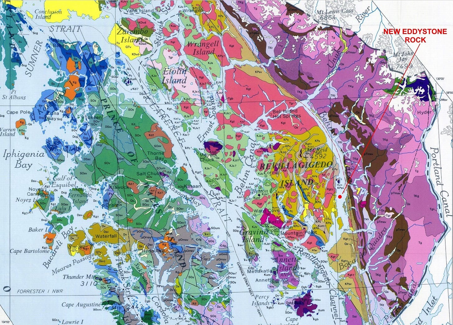
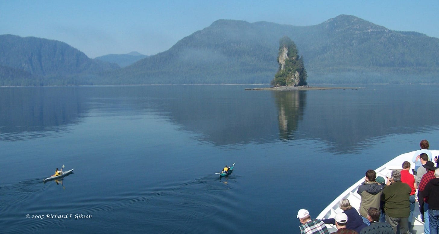
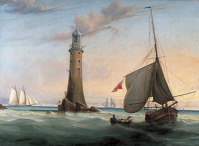
New Eddystone Rock was named by Captain George Vancouver on August 9, 1783, for its morphologic similarity to the Eddystone Lighthouse off Plymouth, England. Vancouver was exploring the fjords of the Alaska Panhandle in search of the western outlet of the Northwest Passage.
This 72-meter-high (237 feet) basalt column is in the Behm Canal, a 174-km-long (108-mile) natural fjord carved by glaciers. There is another 260 meters (850 feet) of the column below sea level and above the floor of the Behm Canal. Calling it a “canal” is misleading albeit common in the Alaska Panhandle; Spanish explorers called these narrow water bodies “canales,” which means “channels,” and English explorers continued the tradition. But there is nothing man-made about the Behm Canal.
The intricate waterway systems of the Alaska Panhandle result from glaciers following pre-existing weak zones—generally, complex fault systems. The region consists of discrete blocks of rocks called terranes, often very different from each other, juxtaposed by various kinds of faulting. Some of that faulting was pushing, resulting from collisions between the different terranes and the North American continent. But the most recent faulting is probably related to the tearing, transform (strike-slip) faulting along branches of the Queen Charlotte fault system. That’s a huge fault zone similar to the San Andreas Fault in California, and it’s breaking the coast of Canada and Alaska in a similar way.

The Behm Canal follows one major fault boundary that’s been active for many millions of years, so it’s not really a surprise that igneous activity, both intrusive and extrusive (volcanic) would be focused along it. The basalt at New Eddystone Rock intruded older rocks along the fault zone as recently as a few thousand years ago. Glaciers came in within the past two million years and were present in Behm Canal until around 15,000 years ago, cutting a huge U-shaped valley that’s now filled with water. Thousands of feet of rock were eroded away, and combined with the melting of the glaciers, the unloading reduced the downward pressure on the land.
Removal of thick glacial ice often results in the land surface rising – “glacial rebound,” more technically an isostatic response to the reduced load. Scandinavia is still rising due to this glacial rebound, at rates of 3 to 9 mm per year, approaching a total rise of 100 meters since the end of the last glacial period. Southeastern Alaska was not covered by a broad, massive continental ice sheet, but the rebound has been enough to stress the pre-existing fault zones so that they’ve cracked, allowing quite recent volcanism to occur, such as that at New Eddystone Rock.
The pinnacle is the core of a volcanic edifice, much of which has eroded away since it erupted about 15,000 to 13,000 years ago essentially at the end of glaciation. That relatively precise date is from radiometric ages of barnacles (13,000 years) on top of lava flows, giving a minimum age, and the timing of glacial retreat (about 15,000 years), giving a maximum age because there is no evidence of eruptions through an ice mass and if the volcanic rock had been older, the glaciers would have certainly scoured those rocks away. Before more proper dating, New Eddystone Rock was grouped with volcanics broadly estimated at five million years ago, which is impossible given the glacial history.
There’s been ongoing volcanic activity in this area, an expression of the continuing tectonic fracturing cracking the earth. One flow in Behm Canal is dated to 8,000 years ago, and an eruption in 1775 killed all residents of a First Nations village in present-day British Columbia (Karl and others, 2013, Pliocene to Recent alkalic volcanic centers in southeastern Alaska: western component of the Northern Cordilleran Volcanic Province: Alaska Geological Society Newsletter, vol. 44, no. 1, p. 1-2).
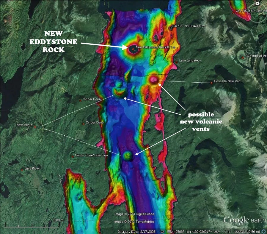
Sonar imagery (map above) from 2009-2013 revealed cinder cones and vents in Behm Canal near New Eddystone Rock, which is the only one above the surface, but the others are likely of similar age or younger.
The photo at the top is from the ship Spirit of Endeavour (since changed hands and changed name) taken in 2005 when I was a geological study leader for a 14-day Smithsonian Journey in Alaska. The kayakers are two rangers, USGS marine biologists, who were camped at New Eddystone Rock where George Vancouver had breakfast in 1793. The rangers came aboard to give us information about the region. This area is within Misty Fjords National Monument.
Vancouver named the Behm Canal for Magnus von Behm, the Russian Governor of Kamchatka, who Vancouver had met in 1779 when James Cook’s ships Resolution and Discovery called there after Cook’s death in Hawaii. Vancouver served under Cook as a midshipman on the Discovery.


Richard, I enjoy your articles. I hope to see something more on the Montana Meteor Impact craters that we visited with Mike Garverich. REUNITE PANGEA
Really enjoy these informative summaries whatever the subject matter.