


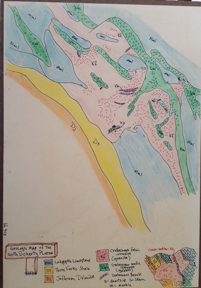
North Doherty Intrusive Complex
Ultramafic-Felsic-Mafic

Life in the USA is not normal. It feels pointless and trivial to be talking about small looks at the fascinating natural world when the country is being dismantled. But these posts will continue, as a statement of resistance. I hope you continue to enjoy and learn from them. Stand Up For Science!
This is one of several maps I made over the years of the little igneous complex north of Mount Doherty, which is just northeast of Cardwell, Montana. I’ve mapped this area at least 17 times, never quite the same way. Multiple rock types make it interesting.
The ultramafic, coarse, pyroxenite gabbro bodies (consisting mostly of pyroxenes and biotite, with notable microscopic olivine according to Tom Kalakay) appear to be more or less sills within the sedimentary package, and more regionally, they appear to be folded along with the sedimentary rocks, so they probably pre-date the folding, but it is possible they were injected as sills into an already folded sedimentary package. Green, Km, on the map above.
The coarse pyroxene crystals are largely held together by biotite mica (and a little feldspar), and consequently the rock weathers quite easily into loose and crumbly masses of pyroxene crystals often as large as a centimeter and often moderately well formed. In some of the drainages, which follow the ultramafic rock because it is so weak, the soil is composed almost entirely of pyroxene crystal grus, the result of the mechanical and chemical weathering of the ultramafic rock. Grus (also spelled gruss) is from German for grit, fine gravel, or debris, and is a common result of weathering coarse igneous rocks (of any type, most commonly granitic).
The other predominant igneous rock, more or less granite or granodiorite (pink, Kf), might have some sill-like aspects (my map interprets it that way), or it might be more of a plug-like blob cutting across the sedimentary rocks (as I show on the cross-section at lower right). It certainly cuts at least the Lodgepole Limestone (blue on the map) and even contains big blocks (the size of several houses at least) of the limestone within the granodiorite as huge xenoliths (“strange rock”). Whether the granodiorite pre-dated the folding, is synchronous with it, or came after, is a little problematic (but a good tectonic question), but I think it’s unlikely that it was significantly later.
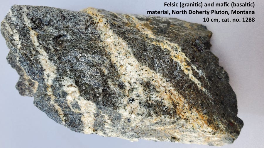
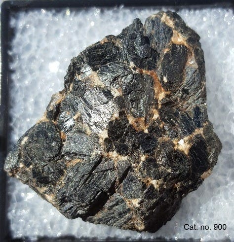
The scattered small basalt features (Kb) are narrow and dike-like and they appear to cut the generally structureless granodiorite, so can be interpreted to be the last of the igneous rocks to form here. Since cross-cutting relationships among the igneous rocks do not occur in outcrop, you have to rely on relationships found in float – loose pieces of rock.
Can you tell from the piece in the photo above which one cuts which, and therefore is younger? I’d say it looks in this chunk like the light cuts the dark, but it’s pretty easy to convince myself otherwise too. I really do not think there is a definitive answer in this piece, and the idea that the mafic basalt cuts the felsic granitic rock really comes more from broader-scale considerations: the mafic material is limited to narrow belts across the much wider felsic rock.
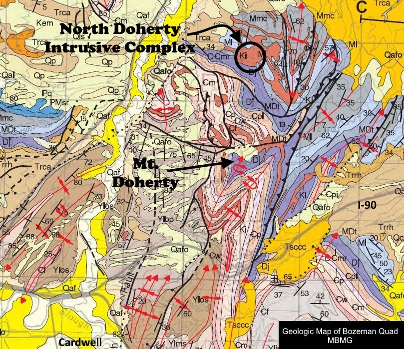
The map above taken from the Montana Bureau of Mines and Geology Bozeman Quad (Vuke and others, 2014), shows the complexity of the region. The North Doherty Igneous Complex is in the black circle toward the top. It lies within the western limb (one side) of a north-plunging syncline in Devonian to Mississippian rocks. I don’t know if the igneous rocks here have been dated, but they are likely about coeval with the Boulder Batholith and other regional intrusives which were emplaced around 75-80 million years ago.
One can sometimes find interesting minerals, mostly in skarn (a metamorphic rock in which the igneous body has introduced new chemicals into the country rock) associated with the cooking of the limestones by the igneous intrusions. These are not spectacular, but fun to find.
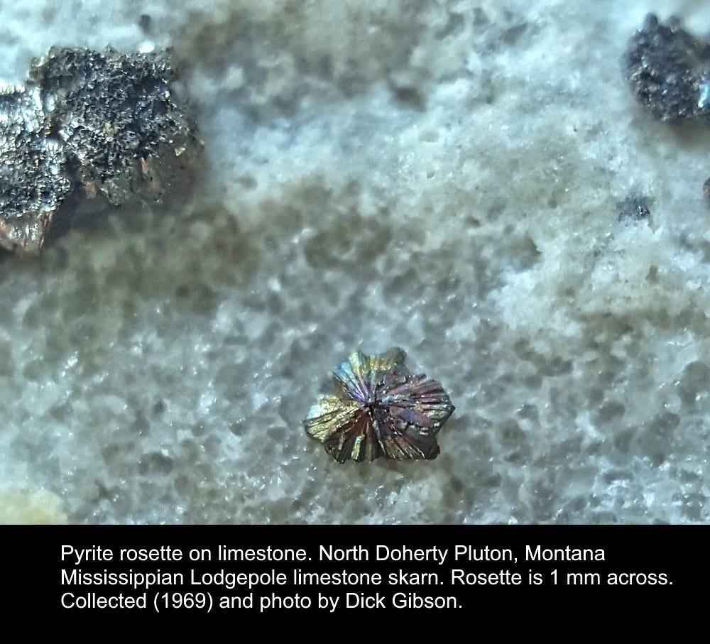
Pyrite rosette, about 1 mm across, on recrystallized limestone (I know it looks like Styrofoam!) of Carboniferous Lodgepole Formation. Collected in 1969.
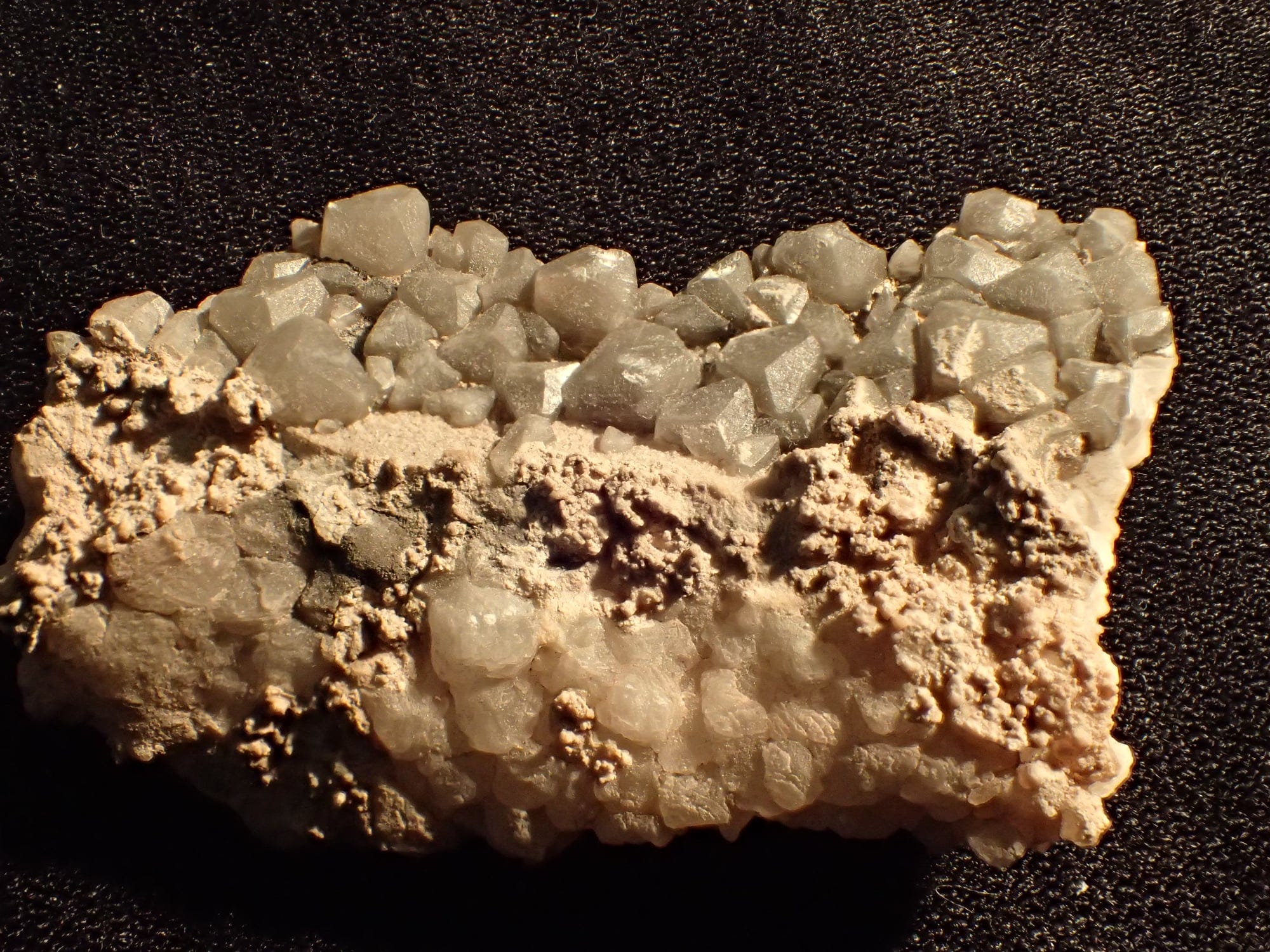
Calcite, recrystallized limestone, about 3 cm wide. In places the limestone is essentially marble.
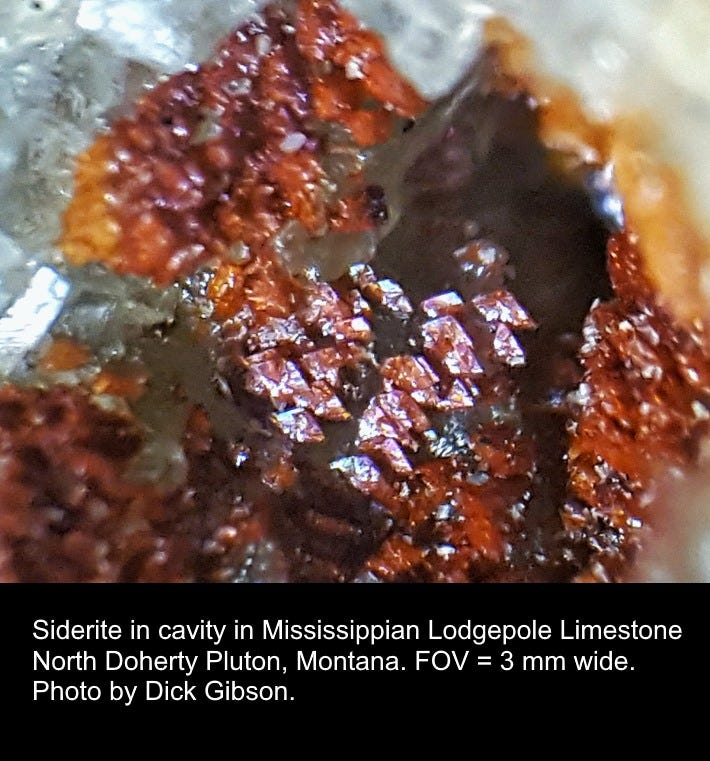
Tiny crystals of red siderite in limestone.
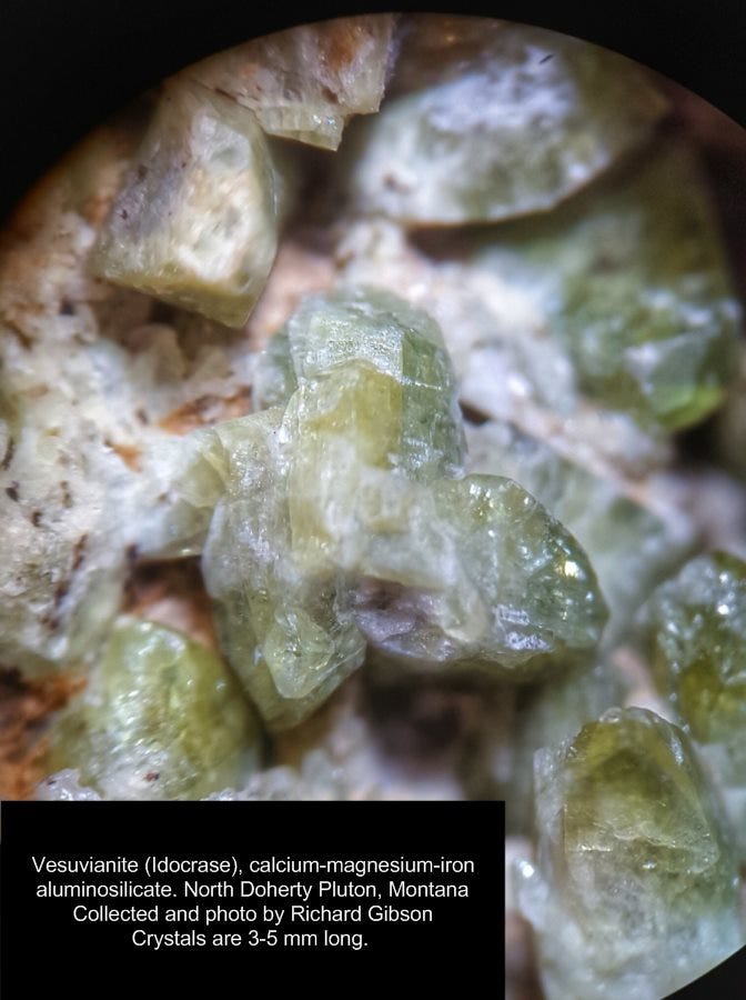
Vesuvianite is moderately common in the skarns, but these were the best crystals I ever found.
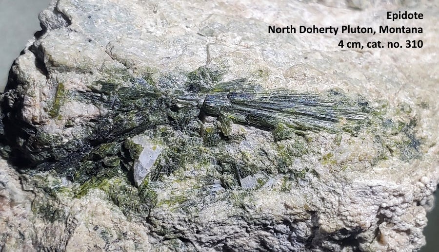
Epidote, calcium-aluminum-iron silicate, can be found in both the carbonate country rock and sometimes in the intrusives as well.
The scale on the map at top has faded to invisibility. The width of the title “sign” at lower left is about a half mile (0.8 km).
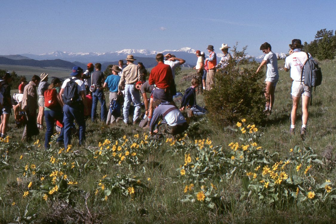
Students preparing to explore and map Mt. Doherty in 1989. Here we are on the southeast flank of the mountain, in the Devonian Jefferson Formation. The mountains to the south in the distance are the Tobacco Roots, and where I am standing to make the photo, the North Doherty Pluton is about 2 miles (3.2 km) behind me.