


Semipalatinsk nuclear test
An artifact in the data set

Life in the USA is not normal. It feels pointless and trivial to be talking about small looks at the fascinating natural world when the country is being dismantled. But these posts will continue, as a statement of resistance. I hope you continue to enjoy and learn from them. Stand Up For Science!
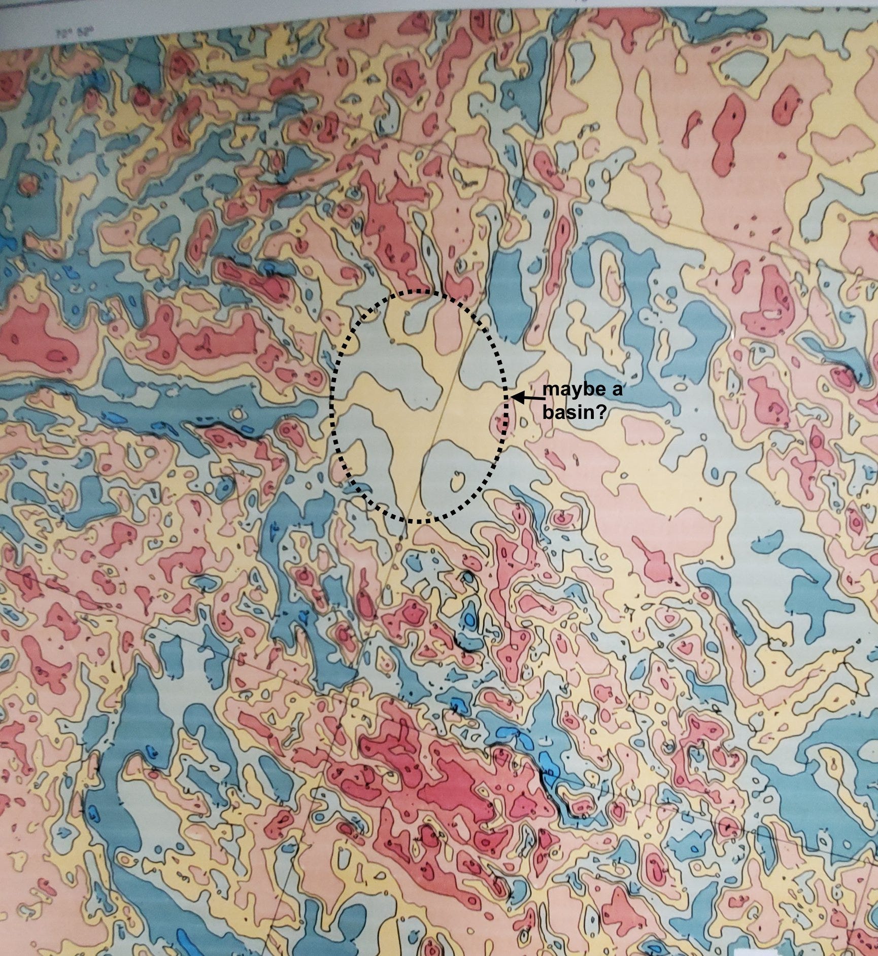
If you have paid close attention to my posts, you’ve learned that the frequency of magnetic anomalies, their narrowness, is proportional to the distance to the magnetic rocks that produce the anomalies. That means that broader features, where the contours are farther apart, often indicate locations where the magnetic basement rocks are at greater depth, and therefore that there may be thicker layers of sedimentary rocks that might be prospective for oil and natural gas. Such locations attract the eyes of people interpreting magnetic maps for hydrocarbon exploration, i.e., me.
Here’s an example from the former Soviet Union, in northeastern Kazakhstan. You see lots of narrow, shallow-source magnetic features, which likely represent either crystalline Precambrian or volcanic rocks on or near the surface, but there’s a nearly circular region (dotted outline) where the contours are much further apart, where whatever is magnetic is much further away, presumably deeper. This might be an interesting little sedimentary basin.
But it’s not. It’s actually an area where the Soviets deliberately degraded the original data that my map here was digitized from – because this is the Semipalatinsk nuclear test site. In the original data, it’s quite apparent that the area degraded is almost perfectly square. There’s no sedimentary basin there.
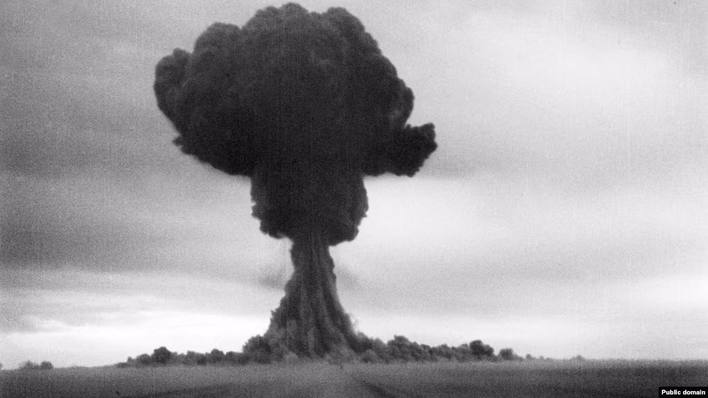
At least 456 nuclear tests were conducted there from 1947-1989; the Kazakhs closed the site in 1991. Although the area was called “uninhabited,” estimates indicate that at least 200,000 residents were medically impacted by downwind fallout from the tests and still are. The 2006 Treaty of Semipalatinsk, signed at the site, established the Central Asian Nuclear-Weapon-Free Zone.
Moral: All data displays are not equal.
“Semipalatinsk” means “seven-chambered city,” for the seven ruined buildings of a Buddhist monastery at the site where the original Russian fort was established in 1718. The Kazakh city today is called Semey.
I was looking at data in the SE USA with a photo overlay. To my surprise there was a striking circular feature. Eventually i realized it was the area of the Savannah River Project, one of three US bomb production sites.
In the late 1930’s a mostly rural site in Georgia was depopulated and fenced. All around the original site, the population grew.
Amazing!