


Life in the USA is not normal. It feels pointless and trivial to be talking about small looks at the fascinating natural world when the country is being dismantled. But these posts will continue, as a statement of resistance. I hope you continue to enjoy and learn from them. Stand Up For Science!
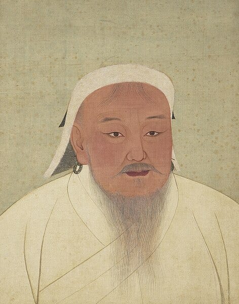
Bukhara, in modern Uzbekistan, was an important stop on the Silk Road and is the only city conquered by Genghis Khan into which he made a triumphal entrance (in 1220); his descendants ruled the city until 1920. Usually he was content to retire to comfort after a military campaign, but Bukhara’s value as a spiritual center led him to the unusual entry, according to Jack Weatherford in Genghis Khan and the Making of the Modern World (2004).
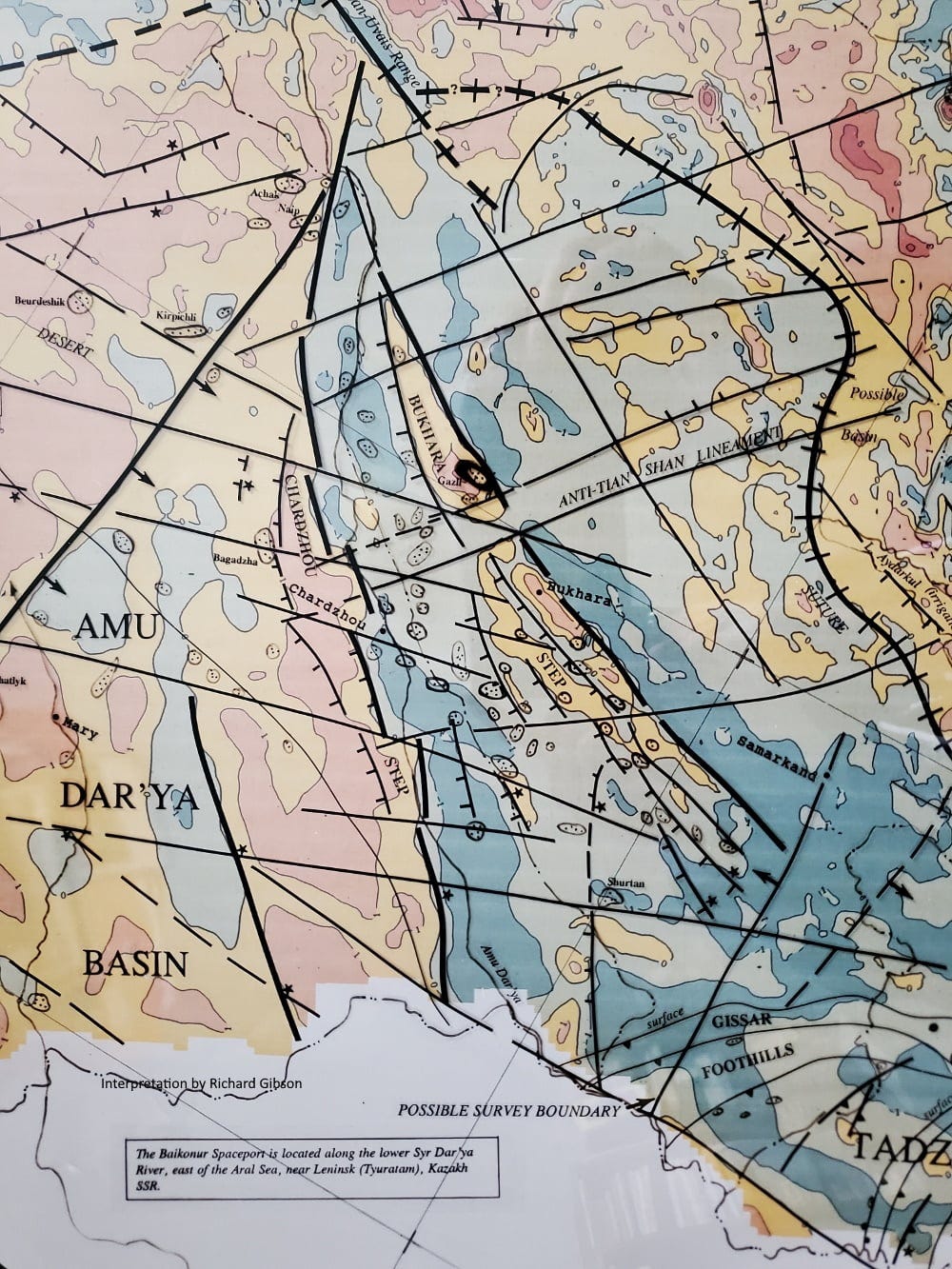
Bukhara gives its name to the Bukhara Step, a subsurface tectonic feature that is important in trapping oil and natural gas. The feature shows nicely on the magnetic map here, part of my 1990 Basement Tectonic Interpretation of the Former Soviet Union. It is called a “step” because it represents a fault-bounded block, which together with the Chardzhou Step to the southwest forms a pair of deep-seated changes in the level of the rocks. There’s no expression to speak of on the surface.
The Bukhara Step is about 500 km long and around 70 km wide. It is the slightly curving row of yellow colors in the midst of a big blue region on the magnetic map. The color change indicates intensity of magnetization, so I infer a linear rock-type change along the Bukhara Step.
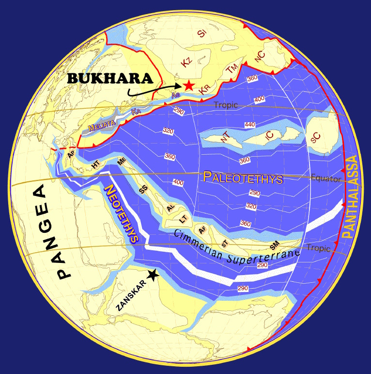
It’s likely that this represents some aspect of the Cimmerian Orogeny, beginning in Late Permian time when several microcontinents including at least the cores of what are now Turkey, Iran, and Afghanistan rifted away from Gondwana and encroached on southern Eurasia, specifically the Kazakh Craton east of the Caspian Sea. The collision between the Cimmeride ribbon continent (“Superterrane” on the map above) and the margin of Eurasia where Bukhara is today would not occur until about 150 million years ago (Late Jurassic), as the Paleo-Tethys Ocean closed.
Whether that interpretation of a linear rock-type change is correct or not is challenging to say, because the magnetic character of the Bukhara and Chardzhou Steps is complicated by the fact of their later uplift, probably a tectonic rejuvenation of the weak zones (rock-type contacts) defining them.
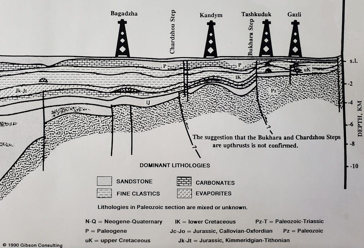
That rejuvenation, probably much more recent (Miocene to present, say 20 million years ago to present), probably comes from the push of Africa and Arabia and India into Eurasia, called the Alpine-Caucasus-Himalayan Orogeny. In Uzbekistan, that tectonic activity is expressed as an additional break along those “steps,” which are usually shown as normal faults (as on the magnetic map at top), but tectonically more likely (in my opinion) to be steep reverse faults, as suggested by the cross section above.
Whatever their tectonic history, these features are subsurface uplifts today and they trap significant hydrocarbons.
The origin of the name Bukhara is uncertain, but it may be derived from indigenous Sogdian βuxārak, place of good fortune, a name given to Buddhist monasteries.