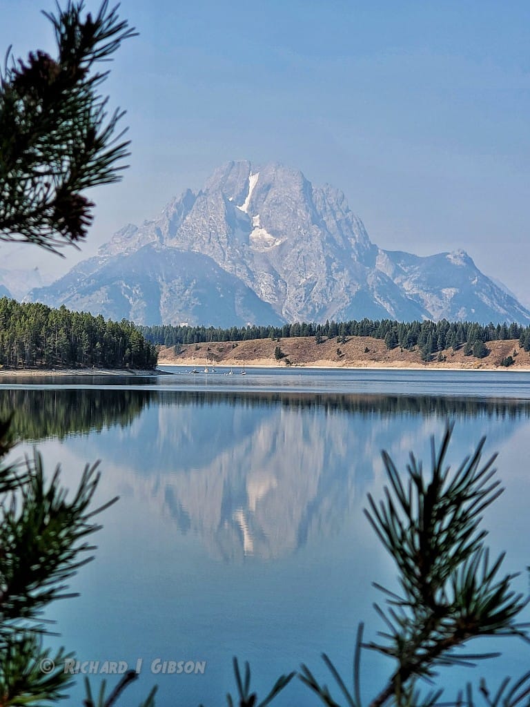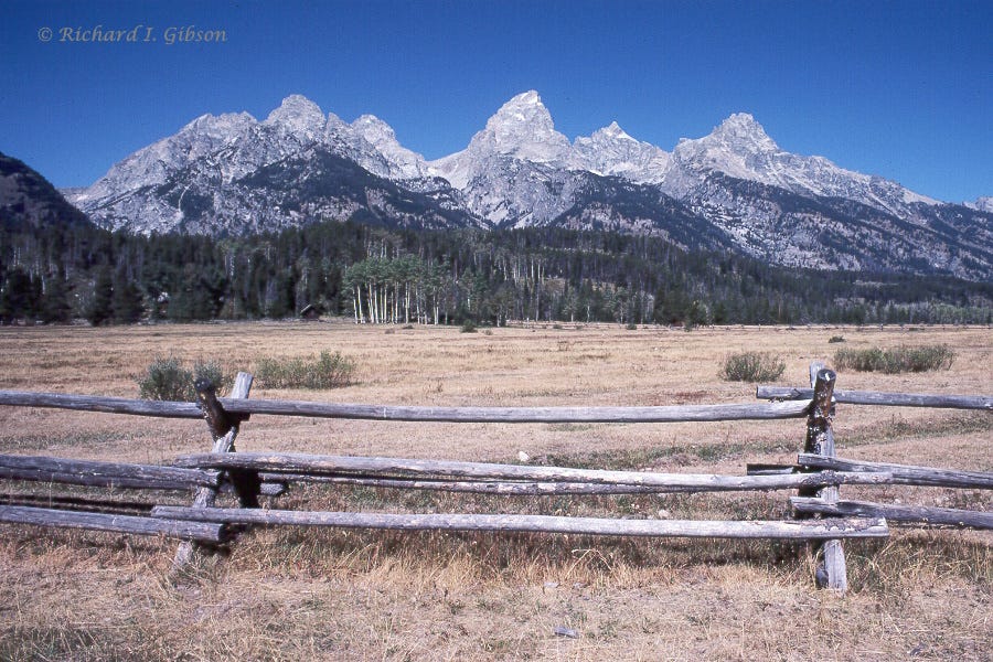
The dark streak extending nearly vertically up the face of the Middle Teton (Teton Range, Wyoming USA) in the photo above is a diabase dike intruded about 780 million years ago. Diabase is a rock that’s compositionally about the same as basalt or gabbro, containing mostly calcic plagioclase and dark ferromagnesian silicates such as pyroxenes. The three rock names, basalt, diabase, and gabbro indicate different textures for the same composition. Basalt is very fine grained (cooled quickly, at or near the surface), diabase has intermediate sized grains (cooled slower, at somewhat greater depth), and gabbro has coarse grains (cooled much more slowly, at greater depth, allowing the crystals to grow larger).

780 million years ago is a poorly understood time in earth history. The older rocks of the Tetons, the gray-white granite gneiss in my photo, are very old, 2.5 to 2.8 billion years, and are part of the Wyoming Craton, one of the early-formed blocks that make up the cores of continents. But there just aren’t many rocks preserved in the time from say 900 to 600 million years ago. One reason for this may be Snowball Earth, a long period of glaciation when virtually the entire planet was covered with ice (and the best-documented Snowball Earth is late, around 650 million years ago); another reason may be that many of the continental masses were relatively stable, neither colliding nor breaking apart much, to create uplifts to erode and basins into which sediment could be shed (and preserved).

Dikes like this one, including the more famous Black Dike in Mt. Moran in the Tetons, are found scattered through western North America from Wyoming north to the Yukon and Great Slave Lake. The activity about 780 million years ago has been called the Gunbarrel Mafic Magmatic Event (Harlan and others, 2003, Geology 31:12), and it might be related to some aspect of the break-up of the supercontinent Rodinia, which had been assembled about 300 million years earlier during the Grenville Orogeny and related collisions.
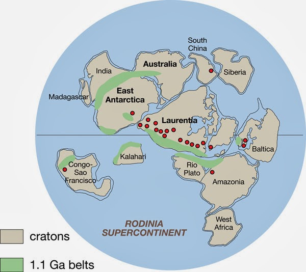
Rodinia is a Russian word meaning the motherland. It’s fair to think of Rodinia as a more or less conglomeration of continental masses, but it’s probably wrong to visualize a concerted assembly followed by a synchronized separation. Just as today, there were probably some pieces coming together while others were drifting apart. But Rodinia does represent a large landmass that contained at least a good number of the continental blocks, for maybe as much as 200 million years.
We really don’t know the details of Rodinia’s configuration all that well. The map above shows one version, but there are plenty of alternatives. While it was one big land mass, it might have served as an insulating blanket over the hot interior of the earth, so that granites pooled along the base of the continental crust and intruded it in places – at least, there are a lot of granite bodies of this age that don’t seem to be related to mountain building. They might represent something like that.
However it was assembled, it began to break apart by about 750 million years ago, and maybe as early as 800 million years ago. The breakup of Rodinia may have impacted both the climate and the evolution of life on earth, as well as providing the extension that led to the dikes in the Tetons.
The uplift that formed the modern Teton Range is a result of extension that is likely related to a bulge caused by the Yellowstone Hot Spot, like the cracking of a brittle crust when something punches up into it from below. That has happened in just the past 6 to 9 million years or so, but despite that recent time frame, the fault zone that marks the front of the Tetons has around 25,000 feet (7,600 m) of throw on it. There’s a small outcrop of the Cambrian Flathead Sandstone on top of Mt. Moran, about 6,000 feet above the valley floor (12,600 feet above sea level). The equivalent rocks beneath Jackson Hole are at least 20,000 feet beneath the surface (14,000 feet below sea level), making the fault offset at least 25,000 feet.
The present-day geometry of the range was sculpted by glaciers within just the past two million years.


Being an "older" geologist, I had always believed that the Tetons were due to basin-and-range extension. I thought the recent faulting responsible for the Tetons and the dramatic fault offset reflected mostly B&R activity. That changed about 10+ or so years ago when I came across the Yellowstone connection with John McPhee's CROSSING THE CRATON or a YouTube talk on Yellowstone/NW Wyoming geology. How I never considered the Yellowstone influence surprises me. JD Love had noted the evidence of sedimentary debris observed in the Gros Ventres that pointed to a topographic high in the eastern Snake River Plain that no longer existed and suggested that it had been due to the Yellowstone Hot Spot. The topographic high collapsing as the inflation moved further to the northeast. It's just a short jump to consider the Teton faulting might reflect the same mechanism.
As a side note, the gravels in the Gros Ventres were a target for possible placer gold when I was traipsing around this part of the country doing minerals exploration. Unfortunately, most of our field staff, including me, were victims of the early 1980's lay-offs and never got to test our hypothesis.
I am a retired geology prof, and I enjoy your posts very much, keeps me in touch at a time in my life when my wife quizzes my about the name of one of my favorite rocks, hornfels, just because I couldn't remember it one time. I got my undergraduate degree at MSU in the late 60's, so I am passingly familiar with much of what you post. I wanted to mention that I, as a USGS field assistant, climbed to the top of Mt. Moran just to inspect the thin bit of Flathead on top.