
Tonga
Tin-can mail

Life in the USA is not normal. It feels pointless and trivial to be talking about small looks at the fascinating natural world when the country is being dismantled. But these posts will continue, as a statement of resistance. I hope you continue to enjoy and learn from them. Stand Up For Science!
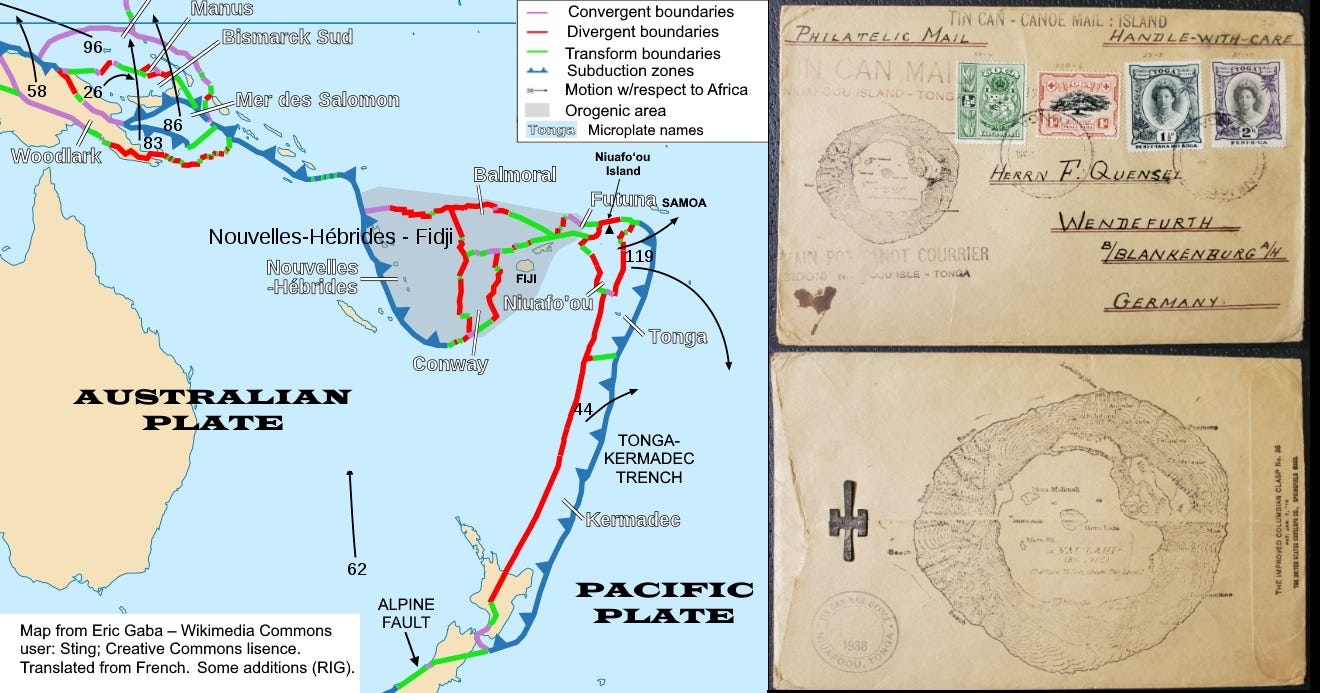
Well, I’ve never been to Tonga, but I kinda like the music. I’ve never worked on a project there either, although I pay attention to its volcanoes and earthquakes. But I do have this 1938 postal item that has a cool map of the island of Niuafoʻou, the most northerly of the islands that comprise the kingdom of Tonga.
Like many of the islands in the central and western Pacific, Niuafoʻou is a volcano. But unlike most of the other Tonga Islands, it’s not part of a volcanic island arc related directly to a subduction zone. The Tonga-Kermadec Trench, one of the most seismically active zones on Earth, marks the position where the oceanic Pacific Plate is diving beneath the Australian Plate – which here is also oceanic. It’s a situation similar to that in the Caribbean, where the oceanic Atlantic Plate is subducting beneath the small oceanic Caribbean Plate, giving rise to the volcanic West Indies.
The plate geometry in the Western Pacific is complex, and the boundary between the two major plates, Pacific and Australian, takes a near right-angle turn not far from Niuafoʻou. Because oceanic crustal plates tend to be weaker than continental plates, in places where things get complicated the plates also tend to break into smaller pieces, and that’s what’s happening here.
The map at top shows one interpretation of broken up microplates in this region. Niuafoʻou appears to be associated with some small rifts in the back-arc area (red lines on the map, indicating extension) west of the subduction zone per se, a setting similar to that in the Taupo Volcanic Zone of New Zealand’s North Island and to an extent, Niuafoʻou represents the continuation of that zone 2,500 km away. The activity is still driven ultimately by the large-scale subduction, but the details of the way the crust breaks are more directly pertinent to Niuafoʻou itself.
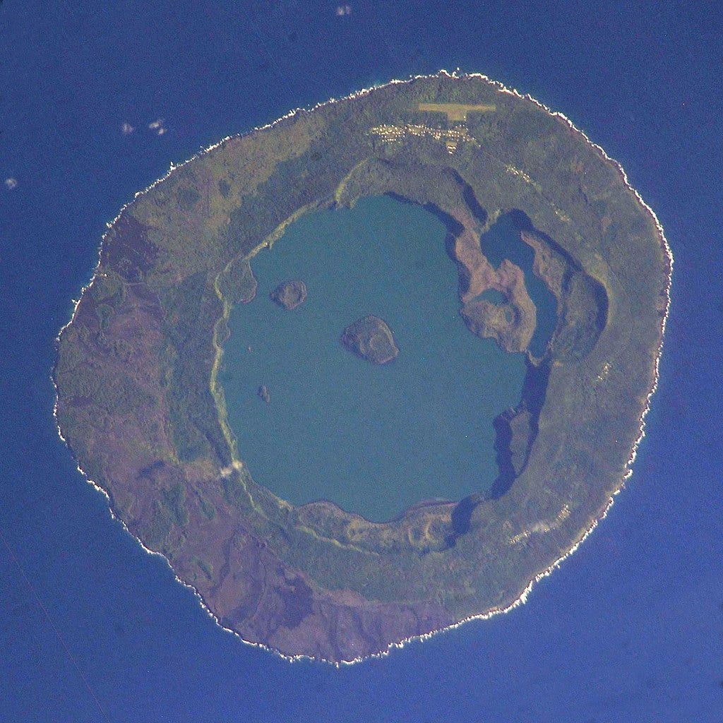
The nearly circular volcano is young and active, with many eruptions in the past 200 years, some quite intense. In 1946 the inhabitants were evacuated and did not return until 1958. The last significant eruption was in 1985. The outer slopes of the volcanic cone are steep, right down to the shoreline, so there is no good anchorage. Consequently, mail between the island and ships was tossed out in biscuit tins to be retrieved by local swimmers. That evolved to canoe transport in the 1930s and the mail sent that way became collectors’ items. The stamped map on both sides of the envelope shows the central crater lake, Vai Lahi (“Big Water”), a small caldera about 4 km across, and other details of the geography that reflect the volcanic geology.
The fact that this envelope is covered with cachets and imprints and is addressed to “F. Quensel” in Germany suggests that is was marked and handled by the more commercial of the two competing “tin can – canoe” couriers on the island in the 1930s, operated by German-born Walter George Quensell, probably a relation of the addressee. The “Tin Can Mail Office” in the backstamp with the year 1938 was first used in that year. These things are quite interesting but there are many hundreds of them and they are not of any huge cash value.
I originally posted this in 2020. The famous explosion of Hunga Tonga-Hunga Haʻapai, several hundred kilometers south of Niuafoʻou, in January 2022 focused attention on Tonga’s volcanoes. For a nice overview of the eruption and tsunamis, see this article by the USGS.
Nice. I had not come across these philatelic items before.