
A diseased rock?
Spots all over

Life in the USA is not normal. It feels pointless and trivial to be talking about small looks at the fascinating natural world when the country is being dismantled. But these posts will continue, as a statement of resistance. I hope you continue to enjoy and learn from them. Stand Up For Science!
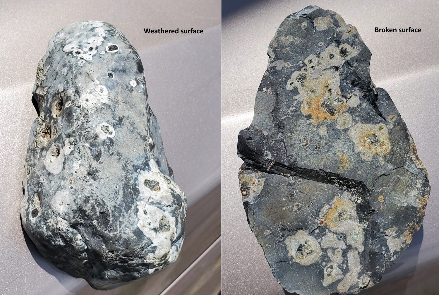
This leprous looking thing is a cobble from Silver Bow Creek south of Gregson Station near Fairmont, Montana USA, that’s about 15 cm long. The enigmatic part is the round white blobs with cores of a dark mineral. They go into the rock and are not just on the surface.
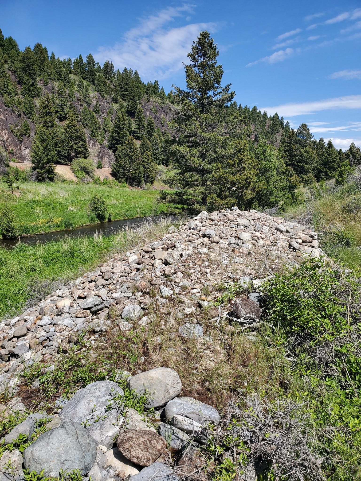
This is from a pile of cobbles and boulders along the creek. I’m fairly sure the pile there is a result of dredging and piling done as part of the reclamation in preparation for re-building the creek and flood plain and adding the walking/biking trail, so they would have come out of the floor of the creek bed. There might also have been some manipulation of the cobbles by early placer gold miners, in the 1860s. I do think they are more or less local, near their original deposited position, rather than hauled in by people from a great distance.
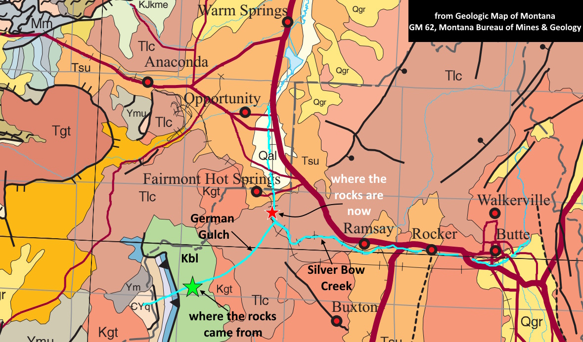
Upstream on Silver Bow Creek the only rocks the stream could have eroded are either Butte Granite or Lowland Creek Volcanics, and this is neither of those. But the location is just downstream from the mouth of German Gulch, and German Gulch drains a complex, highly mineralized and metamorphosed terrain including sedimentary and metasedimentary rocks ranging in age at least from Cambrian to Cretaceous, including about three kilometers of exposure of the Vaughn Member of the Cretaceous Blackleaf Formation (light green, Kbl on the map above; see also McDonald and others, 2012, Geologic map of the Butte South Quad, MBMG Open-File 622).
I’m confident that this rock is a metamorphic hornfels (generated by high heat but low, undirected pressure) from the fine-grained sedimentary rocks of the Vaughn and that it originated up German Gulch about 12 km upstream from the location where I found it. The rocks of the Blackleaf Formation were metamorphosed by intrusive igneous sills about 75-80 million years ago, about 15-20 million years after the Blackleaf was deposited.
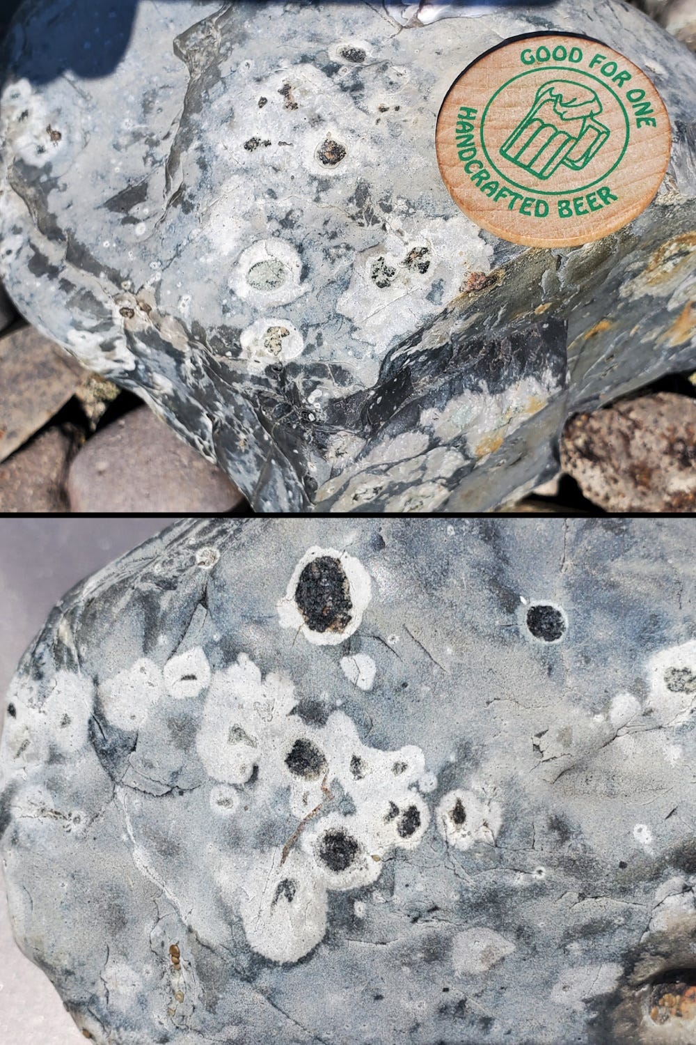
In similar rocks in the region (northern Flint Creek Range, and the east side of Warm Springs Ponds), spots like these are often the mineral cordierite (a magnesium-iron aluminosilicate), which often characterizes hornfelses in metasedimentary rocks. Cordierite is consistent with the observations I can make of the cores of the spots, which seem to be dark blocky crystals that appear to be orthorhombic (box-like in shape, although some of the cores of the spots are almost circular in cross section). Other possibilities include pyroxene or maybe epidote (but epidote is usually greener than these black crystals) or other minerals.
What is the surrounding white halo around the black, inferred cordierite cores? Two possibilities are 1) the cordierite somehow altered the rock around it as it grew, or 2) the elements such as magnesium and iron in the surrounding rock were leached out of it to produce the cordierite crystals. I think it is the latter, but I’m certainly not sure. They may have developed in a manner similar to the “dehydration haloes” around rubies and other corundum crystals.
The original relatively unaltered gray rock is hard, dense, impermeable material, probably silicified and “cooked” in the metamorphic process that made the cordierite. It probably started out as a “dirty” (iron- and magnesium-rich) shale or mudstone, probably including volcanic ash that was the source of some of the silica. The whole package was heated up by igneous sills that intruded along the bedding planes of the shale. The sills provided heat without much directed pressure (such as you get at greater depth where things like gneiss and schist are generated) to make the hornfels.
For cobbles and boulders of this size to be transported at least 10 kilometers down German Gulch and then another kilometer down Silver Bow Creek would take a lot more water than we see today in those drainages. I bet they were brought down 12,000 to 15,000 years ago, when snowfields and glaciers were melting and producing more water, but it must be admitted that the boulders could have been transported by rare but violent flash floods more recently as well.
I guess I’m attracted to spotted rocks. For more, visit this previous post.
This post gave me a chuckle; I am of that age (78) where I have trouble remembering a name of something at times, like my favorite rock, hornfels. My wife often gives me a memory check by spontaneously asking "what is your favorite rock?" Then she times me as I dig about in my memory banks. The reason it is a favorite is because of an outcrop I have studied extensively, on the road between Coloma and Garnet, both ghost towns in the Elk Creek district NE of Missoula. I collected several specimens there, from the hornfels (metamorphosed paleozics) to the contact with a Tertiary igneous intrusion, and a few inches into the intrusion itself. I could spend a lifetime looking at these thin sections, details of the cordierite with multiple inclusions, pure clear quartz and feldspar right at the contact, flow oriented platy minerals some distance into the intrusion, and then the intrusion itself. I used this suite of rocks and thin sections for years in my mineralogy-petrology classes. Two feet of exposure, a textbook lesson. And yes, I remember the name of my favorite rock, at least tonight.