
Beaverhead Rock
Recognized in isolation

Life in the USA is not normal. It feels pointless and trivial to be talking about small looks at the fascinating natural world when the country is being dismantled. But these posts will continue, as a statement of resistance. I hope you continue to enjoy and learn from them. Stand Up For Science!
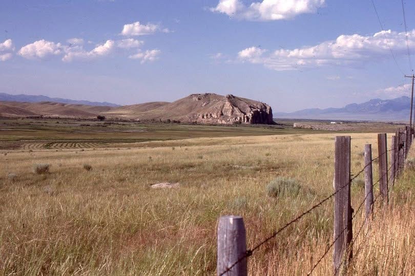
Beaverhead Rock along the Beaverhead River in southwestern Montana is famous as the feature recognized by Sacagawea, Lewis and Clark’s Shoshone guide, on August 8, 1805, placing the Corps of Discovery somewhere near the Continental Divide.
The rock of Beaverhead Rock is the Mississippian-age (Early Carboniferous) Madison Limestone, a thick package laid down in mostly shallow, warm water about 330 million years ago. Montana’s Madison Limestone and its equivalents record a seaway that extended from Arizona to Alberta and east to Indiana and beyond. See the map and photos in this previous post for more about the shallow Carboniferous sea in North America.
Apart from its distinctive shape, the outcrop is also prominent because it is isolated, one of few large exposures of rock anywhere near the river over a distance of many miles. The isolation is a consequence of complex tectonics.
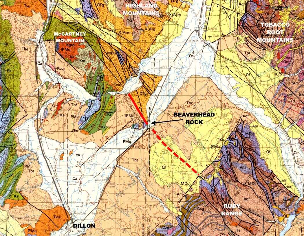
The northeast-southwest trending Beaverhead River valley is in a graben, a down-faulted zone resulting from extension, pulling apart, of the entire region. This dates to around 35 to 15 million years ago and to some extent is going on today. The lightest colors on the map above, labeled Qa, represent the alluvium and recent deposits from the modern river system.
The valley is narrowest at Beaverhead Rock. I think that’s because of the northwest-trending fault zone there, highlighted on the map and with a dashed probable extension to the Ruby Range, where numerous northwest-trending faults are mapped. This northwest-southeast structural grain dominates the Tobacco Roots, the Ruby Range, and parts of the Highland Mountains, and probably derives from a very old (Paleoproterozoic, at least 1,700 million years ago) fault system that has been repeatedly reactivated over time up to the present.
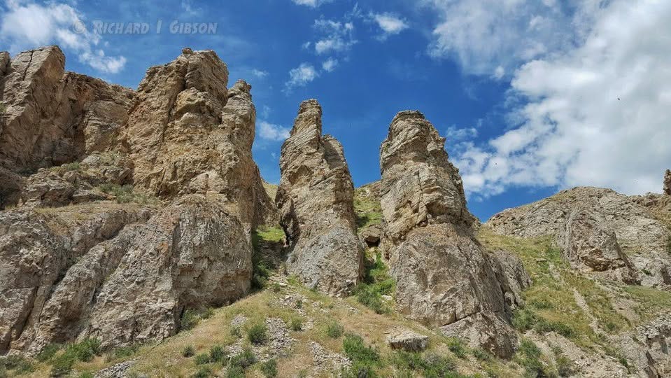
The part of the Madison Limestone that’s exposed on Beaverhead Rock is the upper part, the Mission Canyon Limestone, which contains broken (brecciated), collapsed rock in paleokarst. Karst topography develops when limestone dissolves to produce caves and other features; paleokarst is the same thing, but in this case it developed perhaps 300 million years ago, soon after the Mission Canyon Formation was deposited. The rocks must have been uplifted and exposed at the surface where ground water created caves that later collapsed to form the broken rock and cavities we often see at the top of the Mission Canyon Formation.
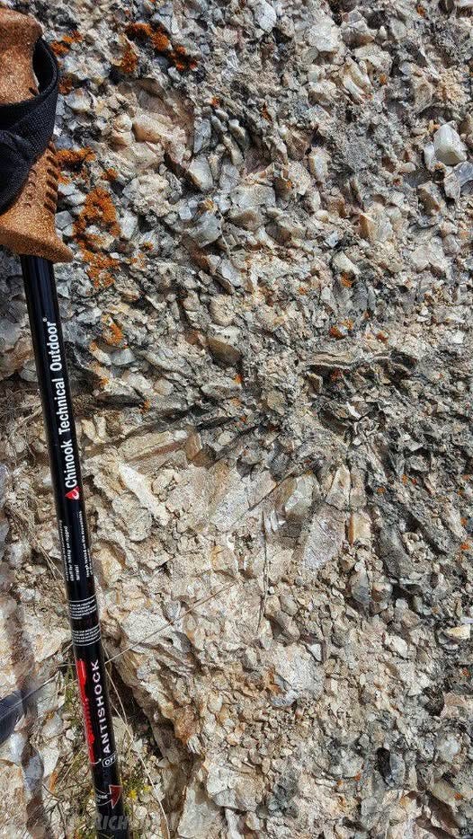
Cavities now containing large calcite crystals probably developed during a second phase of dissolution and re-deposition that dates to Oligocene-Miocene time when southwest Montana was much wetter than it is today, but the cracks often follow the old collapse structures in the paleokarst. In places, not-very-well-formed calcite crystals reach 6-7 cm like those in the photo above. It’s a State Park so collecting is not allowed.
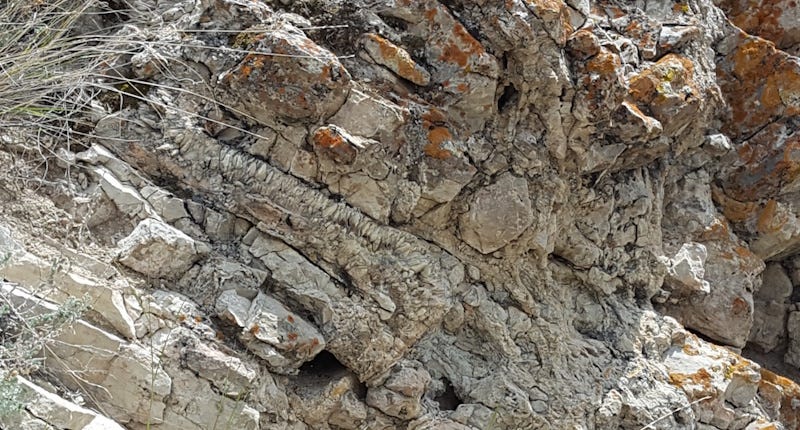
The calcite crystals in the photo above, left of center, are about 5 cm long and occupy an S-shaped opening in the rock.
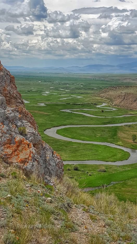
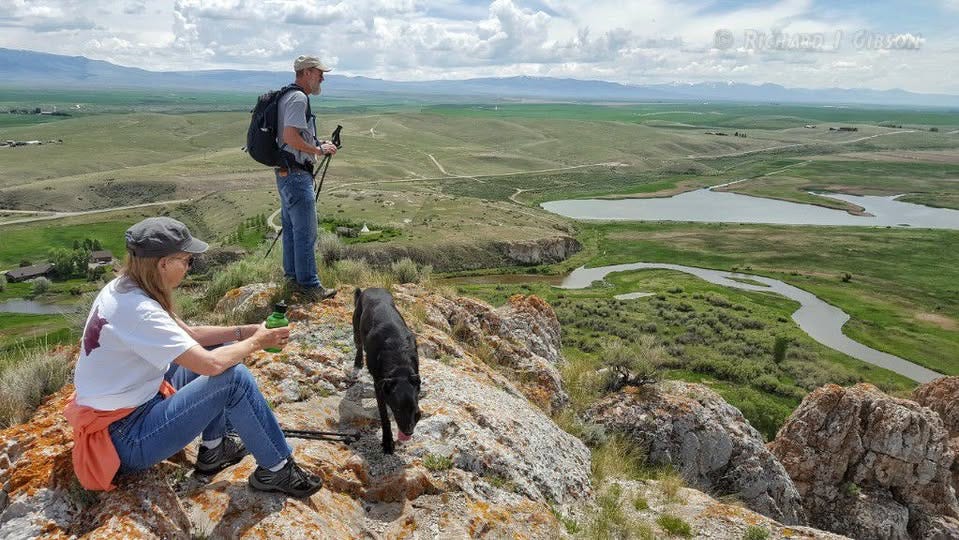
The Beaverhead River seen from Beaverhead Rock shows beautiful meanders. This part of the stream system is a relatively low-gradient river, allowing the lazy meanders to develop.
Interesting, the faulting is really complex around BHR, but looking at the faults as mapped it looks like BHR is in a Horst bounded by the two NE trending normal faults, and cut off on the NE end by the normal fault mapped in red, with also looks like it is down on the NE side. Like the bow of a sunken ship sticking out of the water?
Great read and the photos are lovely. Thank you for the time you put into these fascinating articles.