Today I’m heading to the University of Montana-Western in Dillon, Montana, to give a talk on the geology and history along the Silver Bow Creek Greenway Trail between Butte and Anaconda. Here’s a tidbit from the talk and the forthcoming guidebook I’m writing.
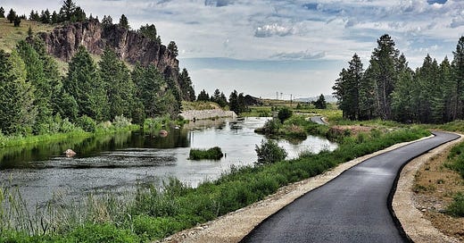
Even the rip-rap (sometimes called rock armour in British English), the material brought in to support the abutment of the fish barrier/dam south of Gregson Station, is interesting. The dam creates the scenic pond in the top photo, a fishery and a habitat for great blue herons, Canada geese, and more – a friend has seen a moose there too, and mountain lion prints have been seen within a mile of here.
As a fish barrier, it is intended to keep downstream non-native brown and brook trout from competing with the native cutthroat trout population upstream. This barrier cost about $500,000 and is part of the environmental remediation largely paid for by funds from Arco (British Petroleum), the successor to the Anaconda Company and responsible for the environmental problems. Twenty years ago, the stretch of creek in the top photo was a dead stream, no fish, insects, or birds, and few plants could tolerate the toxic pollution there.
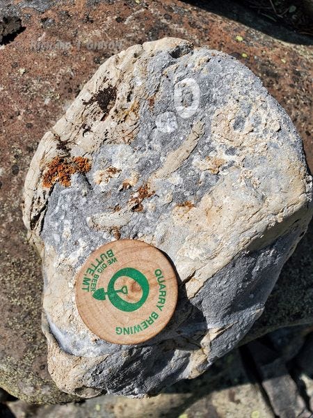
Although I don’t know for certain where it was quarried, I do know for sure what the rock in the abutment is: the Mississippian (Lower Carboniferous) Mission Canyon Limestone, part of the Madison Group.

The Mississippian Period, about 330 million years ago, was a time of warm shallow seas across much of North America, and the equator passed near what is now Montana. Rocks equivalent to the Madison Group extend to the Grand Canyon (Redwall Limestone), northern Canada, and east into Indiana and beyond.
Although the related underlying Lodgepole Formation contains more fossils than the Mission Canyon, some occur in the fine-grained limestone of the Mission Canyon Formation in the rip-rap. Much more evident is the brecciation, the breaking of the limestone into fragments – breaking that happened millions of years ago, when the upper part of the Mission Canyon was exposed to the surface above sea level, and karst topography (caves, sinkholes, and other solution features) developed. Many of the caves and dissolved cracks and joints collapsed, resulting in the brecciation.

The brecciation probably happened after the overlying Amsden Formation was deposited, because often the broken collapse features in the Mission Canyon are stained red or infilled with reddish sediment that probably came from the red shale of the Amsden Formation.
In some places, the cavities that were initiated during the dissolution remained partly open and allowed later percolation of water to dissolve some of the limestone and re-precipitate it as calcite crystals.
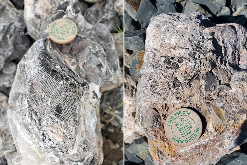
Another feature, almost unique to the Mission Canyon, is wood-grain chert, and the best examples I’ve ever seen are in the rip-rap at the fish barrier abutment.
Chert is fine-grained silica (quartz) that is common in sedimentary rocks, especially limestones (carbonates). It’s usually inferred to form by dehydration and lithification of siliceous oozes in the carbonate sea, oozes that probably reflect accumulations of the remains of siliceous microorganisms like radiolarians and diatoms, but it can form abiotically too. It’s usually black, gray, or brown, and it may form in beds or as nodules within the limestone. Internally, chert usually is just massive or finely granular and has no visible structure macroscopically.
The laminated wood-grain appearance is an unusual exception. The layers are about a millimeter apart. The dark bands are pretty standard gray-black chert, essentially nothing but silica, SiO2. The light bands are also chert, but they contain enough calcite, calcium carbonate (the primary constituent of limestone) that they effervesce in hydrochloric acid (the standard test for calcite) even though they are hard like chert.
The alternating bands must reflect some periodic alternation in the siliceous ooze that resulted in the chert, but exactly what it was is debated. One detailed study (DeCelles and Gutschick, 1983, Mississippian wood-grained chert and its significance in the western interior United States (Deseret limestone): J. Sed. Research, 53 (4): 1175–1191) suggests that the banding formed in siliceous material near the base of the pycnocline, the transition zone of mixing between shallow, warmer, less dense ocean (or lake) water and deeper, cooler, denser water.
The right photo above shows some of the wood-grain chert that is broken up, involved in the brecciation of the limestone package in which it occurs. The reddish tinge is the likely staining from the Amsden Formation I mentioned above.


Interesting about the formation of the chert. I didn't know that. I would assume that flint nodules in chalk perhaps form in a similar way? (Also, you have a few rip-rips 😁)