


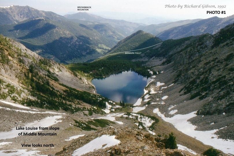
Bismark Fault and Lake Louise
Tobacco Root Mountains, Montana USA

Life in the USA is not normal. It feels pointless and trivial to be talking about small looks at the fascinating natural world when the country is being dismantled. But these posts will continue, as a statement of resistance. I hope you continue to enjoy and learn from them. Stand Up For Science!
This view looking north over Lake Louise in the Tobacco Root Mountains of Montana includes mostly Archaean (more than 2.5 billion years old, though many had their ages re-set about 1.8 billion years ago, Paleoproterozoic time) rocks in the scree and in the near- and middle-distance tree-covered slopes. Similar rocks underlie the high snow-covered mountain at upper left. The Bismark Fault Zone cuts these rocks and brings a prong of the Cretaceous Tobacco Root Batholith (76-million-year-old granitic rocks) into this view, in the pointed, treed point just beyond Lake Louise, beyond the dotted line indicating the Bismark Fault. More of the young granitic rocks of the Tobacco Root Batholith are visible in the top photo at the far upper right, which is the west flank of Hollow Top Mountain.
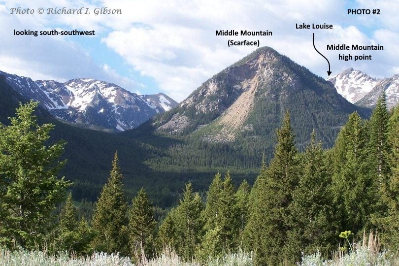
From the other direction, looking south-southwest, you see the big landslide scar often called Scarface on the far (north-facing) side of that treed point. The high part of Middle Mountain is to the right behind the tree-covered Scarface and Lake Louise sits between those two branches of the mountain. The landslide is prehistoric.
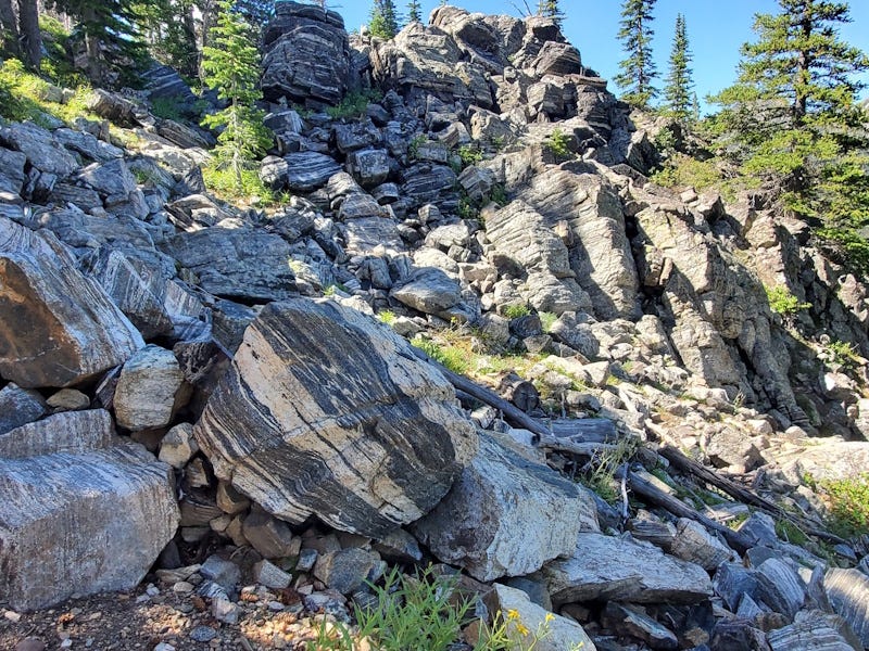
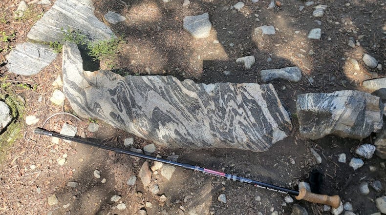
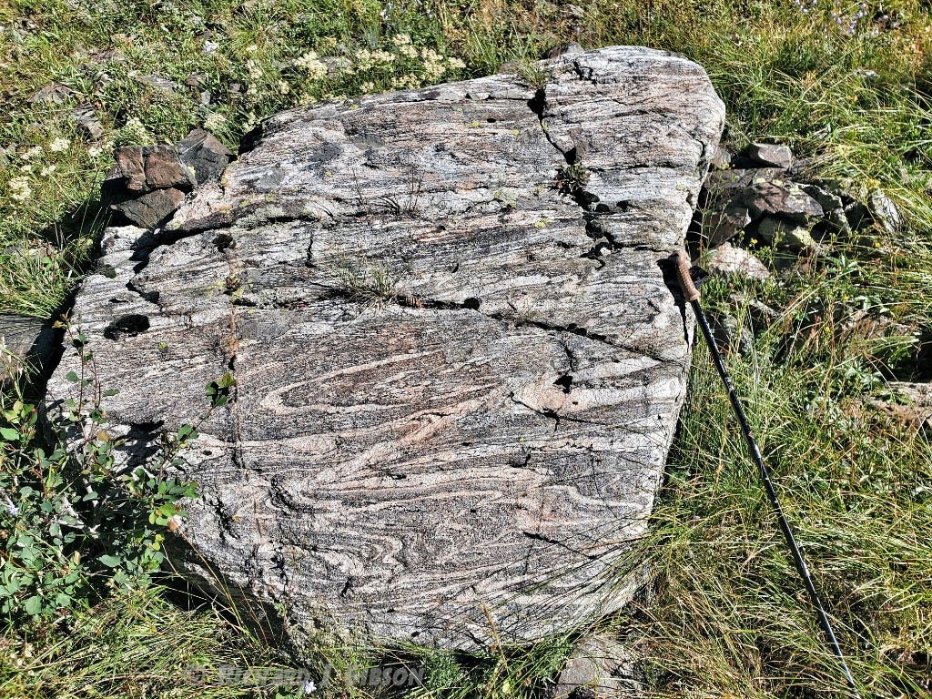
The rocks along the trail to Lake Louise are mostly black and white hornblende gneiss, strongly layered (the metamorphic foliation) but deformed (folded) at least two or three times.
The northwest-trending Bismark Fault has a heritage dating back to at least 1.4 billion years ago, when the much older Achaean rocks were being broken by the faults that formed the southern margin of a branch of the Belt Basin. Many of those northwest-trending faults (but not, so far as we’ve seen, the Bismark Fault) were intruded about 1.1 billion years ago by mafic diabase dikes (Yd on the map below, along the Mammoth Fault), and they may have moved again at about that time. They were reactivated again about 70 to 50 million years ago during the mountain building that created the present-day ranges of southwestern Montana.
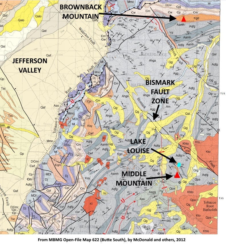
In the distance in the top photo you see Brownback Mountain labeled. You have to go almost that far (8.5 miles, 14 km) from Lake Louise to get out of the Precambrian rocks and the Tobacco Root Batholith, that far to find the Paleozoic rocks, specifically the Cambrian, about 530 million years old. Brownback Mountain is an igneous sill -- that means it is concordant with, its sides parallel to, the bedded layers of the sedimentary rocks it intrudes. It’s quite a fat sill, a half mile wide at the surface, pushing apart the layers of the Cambrian Flathead Sandstone and the Cambrian Wolsey Siltstone and Shale. It’s approximately the same age as the Tobacco Root Batholith and might be related to it, although there are variations in the chemistry of those more-or-less granitic rocks.
For the top photo, I’m standing maybe two-thirds of the way up the north-facing cirque wall of Middle Mountain in this 1992 photo. Lake Louise occupies the low part of the cirque (a bowl-shaped depression that forms near the head of a valley glacier). The valley at left-center and passing to the right of Brownback Mountain holds the South Boulder River.
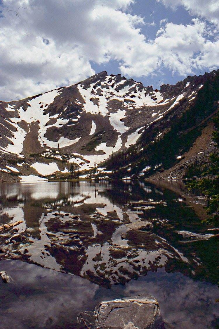
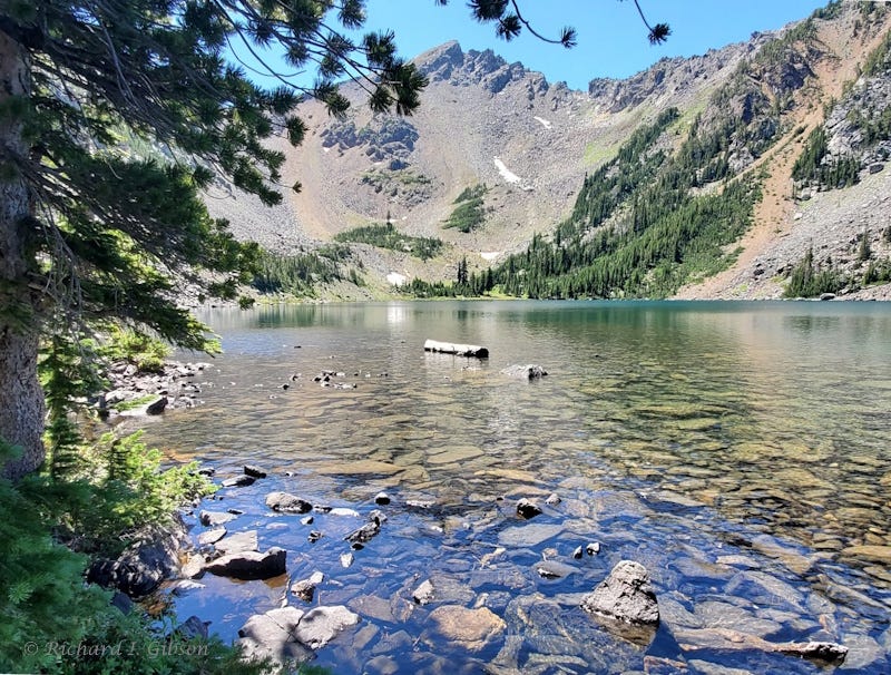
These two views of Lake Louise and the ragged high point of Middle Mountain are 31 years apart. The snowy view is from June 1992, and the other is from August 2023.
That’s great!
The Tobacco Roots have fascinated me ever since I first laid eyes on them, coming down off the Continental Divide on I-90 one evening as the alpenglow lit them up.
I never made it back there to see them again.