
Jefferson River Thrust Faults
Montana

Life in the USA is not normal. It feels pointless and trivial to be talking about small looks at the fascinating natural world when the country is being dismantled. But these posts will continue, as a statement of resistance. I hope you continue to enjoy and learn from them. Stand Up For Science!
We can’t let June 3, 2026, go by without noting the 300th anniversary of James Hutton’s birth. I honored the “Father of Geology” in this previous post.
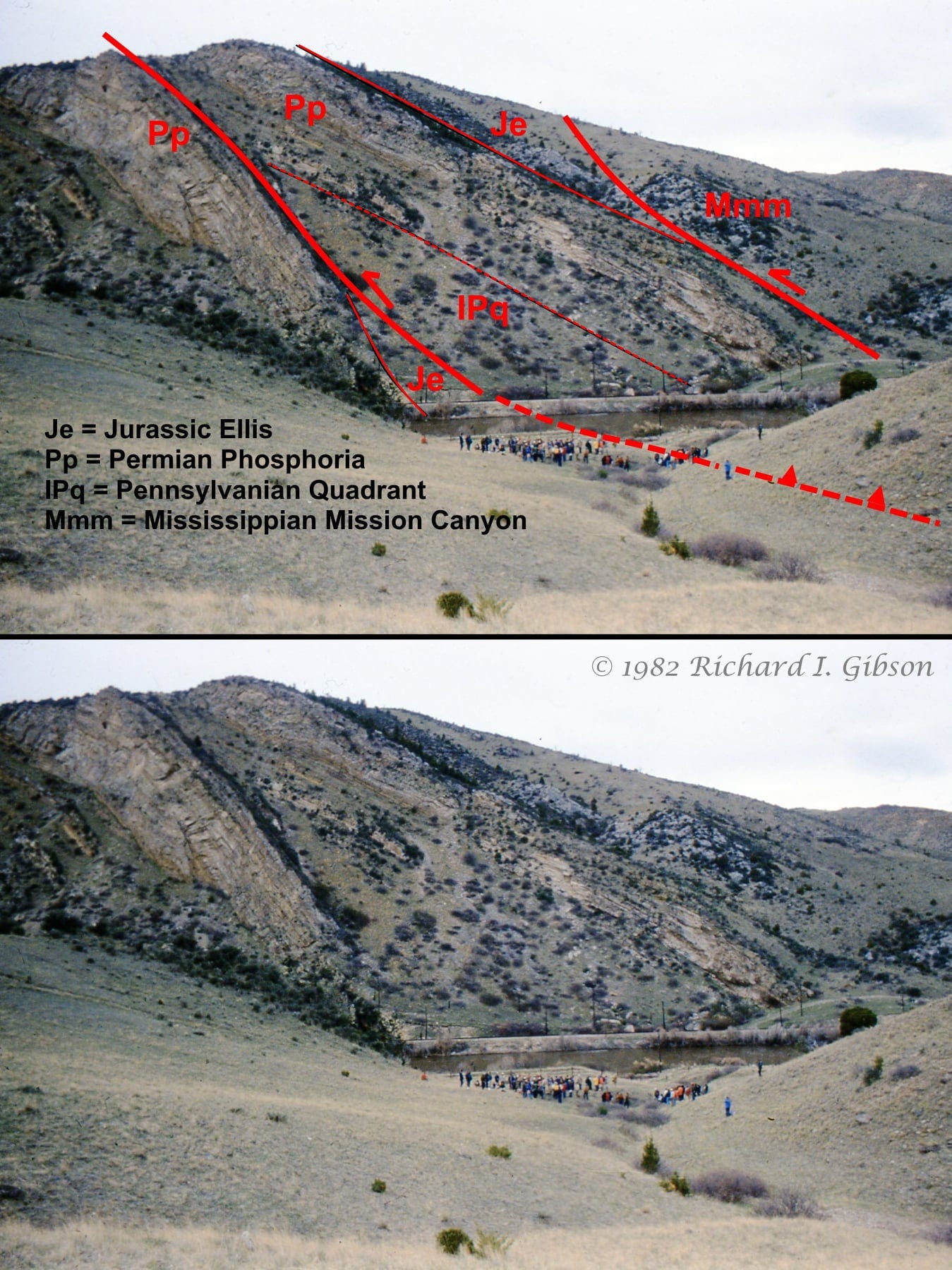
The view above is looking west across the Jefferson River, east of Lewis and Clark Caverns, south of Montana Hwy 2. This photo is from a field trip in 1982 led by Chris Schmidt for the Rocky Mountain Section of the Geological Society of America.
The location is within the Southwest Montana Transverse Zone, a more or less east-west zone of faults and folds that represent one aspect of the interactions between two tectonic styles: “thin-skinned” thrust faults, in which (almost exclusively) layered sedimentary rocks are pushed up and over “thick-skinned” features that result from brittle deformation of thick, mostly non-layered Precambrian crystalline basement. Not only are the two styles different in their mechanical behavior, the faults and folds related to each often have differing orientations, and in some places they developed at different times (although in the northern Tobacco Roots and elsewhere, they fairly clearly overlapped in time and space at least somewhat, making it reasonable to call them two aspects of the same stress and deformation pattern).
Although the general push in western Montana was from west to east, in the Jefferson Canyon and points east some of the sedimentary rocks were shoved relatively to the south, up and over a crystalline Precambrian block that served as a buttress to those thin-skinned thrust faults. In the photo, the crystalline rocks crop out about 2.5 miles to the left (south). These faults would be called oblique thrusts because they have elements of both standard thrusts (up and over) and strike-slip faults (with horizontal separation). Here, the Jefferson River is flowing about north to south, right to left in the photos.

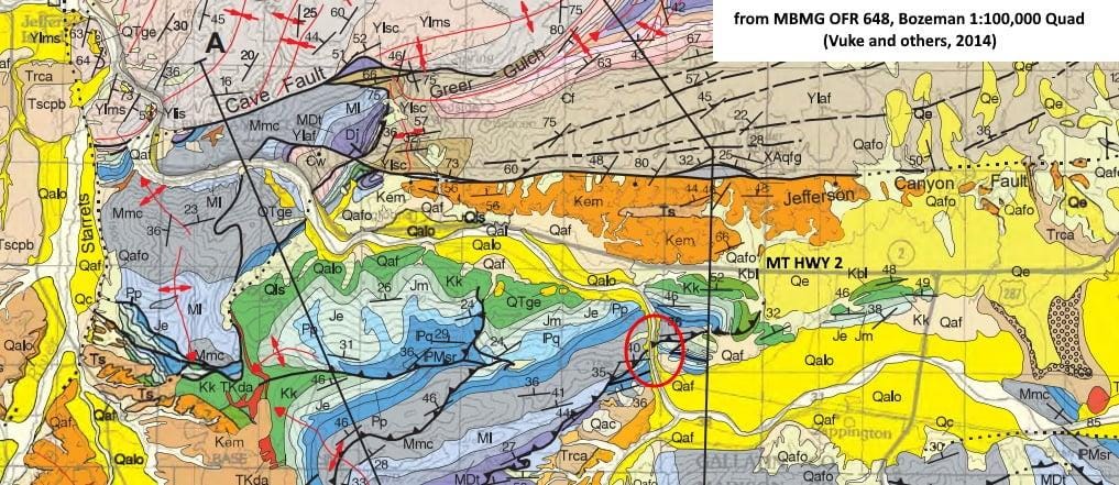
The second photo pair above shows the same section from a slightly different angle. The map below (Vuke et al., 2014, MBMG Bozeman quad) shows the location of the photos in the red circle.
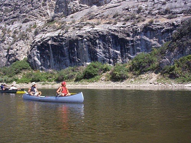
I’ve never been across the river into those rocks (although I have been on the river here in a canoe), so precisely where you’d put the Quadrant-Phosphoria contact might be debated, but that’s a somewhat subjective contact anyway. It’s certainly somewhere about where my line is drawn. Both faults shown here continue east (behind where I’m standing to make the west-looking photo) where they’ve been mapped by countless students in the Indiana University geologic field course. Even though I’ve explored that area myself at least 19 times, interesting problems remain in detail even though the overall tectonic picture is pretty clear.
That Precambrian crystalline block is usually called the Dillon Block, and includes the cores of the Tobacco Root, Ruby, Blacktail Deer, Snowcrest, Gravelly, and Madison mountain ranges as well as parts of the Highlands and others. The fold-thrust belt wraps around the Dillon Block on the west and north. The Dillon Block is almost certainly a northwestern prong of the Archaean Wyoming Craton, although most of the pre-2.5-billion-year-old rocks in the Dillon Block were overprinted by metamorphism and deformation in the Big Sky Orogeny, so most of the age dates for the Precambrian crystalline rocks there come out around 1.78 to 1.72 billion years, Paleoproterozoic time.
The fault may look huge in comparison to the crowd of people (it is!), but in the grand scheme, these two faults really don’t have very much offset, and are probably fairly minor adjustments that accommodate squeezing on the flank of the Dillon Block.
There’s an entire 582-page GSA Memoir (#171, Interaction of the Rocky Mountain Foreland and the Cordilleran Thrust Belt, 1988, co-edited by Chris Schmidt and Bill Perry) devoted to the problems of this tectonic interaction.
Another fascinating essay. Thanks. I shared it to a niece who lives in Osburn, Idaho, and works in environmental protection, with a focus on mines and contamination. She has a list of geologic sites to visit, in Idaho and Montana, and will add this.