
Timan-Pechora
A small addition to Europe

Life in the USA is not normal. It feels pointless and trivial to be talking about small looks at the fascinating natural world when the country is being dismantled. But these posts will continue, as a statement of resistance. I hope you continue to enjoy and learn from them. Stand Up For Science!
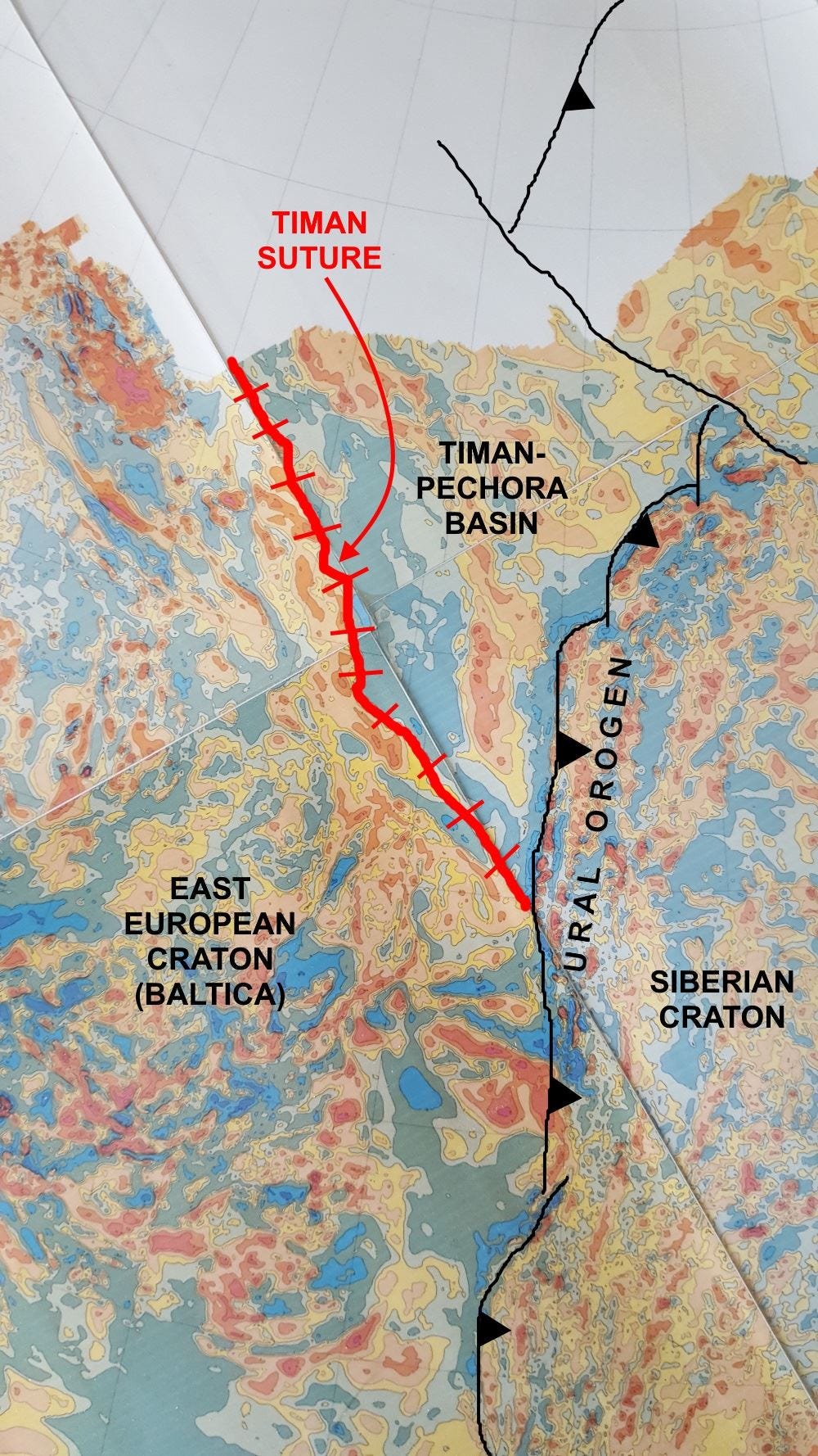
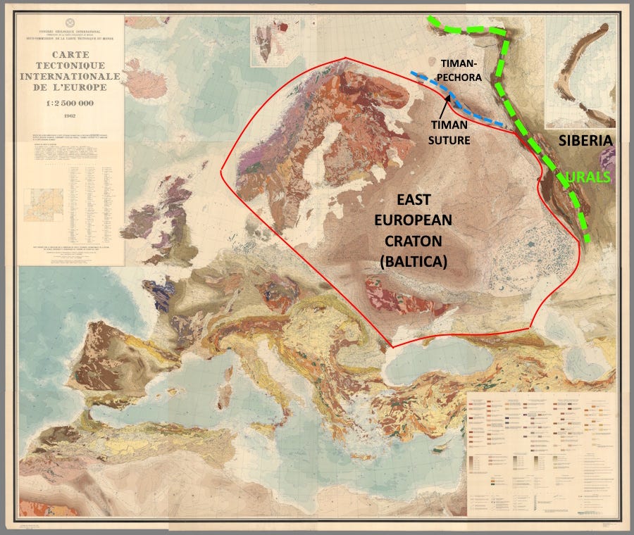
This is part of the magnetic map of the former Soviet Union. It reveals three continental blocks and their amalgamation to form part of Eurasia. The Siberian Craton (a craton is a strong, usually fairly old block of continental crust) collided with and became attached to the East European Craton beginning about 300 million years ago, about the same time as Europe and Africa began to collide with North America to form the Appalachians. Here, the collision produced the Ural Mountains (orogeny means mountain building). The Ural-building collision went on for close to 100 million years.
Much longer ago, at least 520 million years ago and maybe as long ago as 650 million years, a relatively small continental block, labeled “Timan-Pechora Basin” in the image, was amalgamated to the East European Craton. The Timan Suture marks the position of that collision. Today that’s just a range of low hills, but it would have been high mountains at the time of the collision. The Timan-Pechora block was fully part of the East European Craton when Siberia collided with both of them 200 million years later.
Between the old Timan Suture and the younger Ural collision belt, the main mass of the small Timan craton was relatively low, becoming the Timan-Pechora Basin, where shallow marine waters occupied what then was the margin of the European Craton.
In Devonian times, around 405 million years ago, irregularities in this marginal sea floor supported extensive coral reefs. Reef complexes often create excellent hydrocarbon systems, with organic-rich source rocks in deeper water adjacent to the reefs or in stagnant lagoons behind the reefs, while the reefs themselves, with highly porous coral growth, make good reservoir rocks. In the Timan-Pechora Basin, source rocks as rich as 4% to 6% organic carbon are present – and that’s very, very good source rock (Klimenko and others, 2011, The Timan-Pechora sedimentary basin: Palaeozoic reef formations and petroleum systems: Geological Society of London Memoir 35(1):223-236).
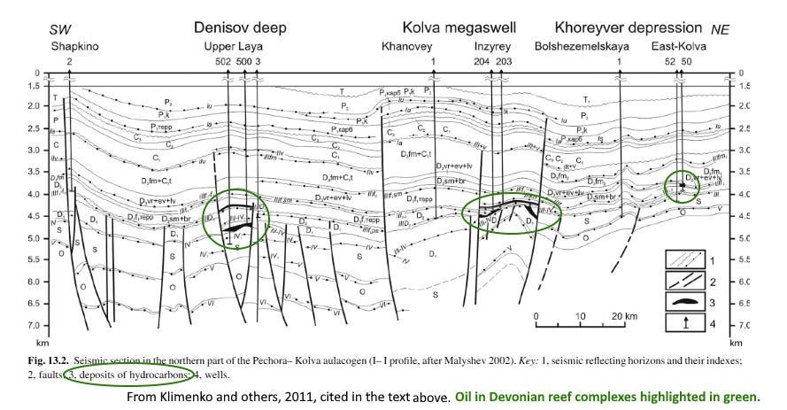
Later deposits sealed the entire source-reef complex, burying it to convert the organic material (mostly plants and algae) into oil and natural gas. In some cases the reef itself might be sufficient to serve as a trap for the oil and gas, but here, the encroaching Siberian Craton provided an extra push, breaking the basin into large faulted uplifts that further enhanced the oil traps.
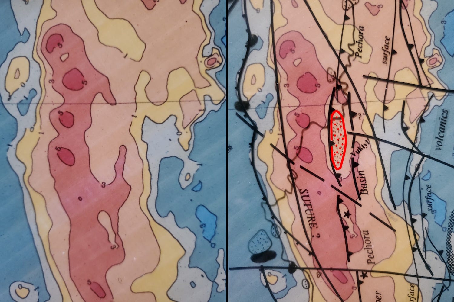
Because in some places those faults involve the magnetic basement, I was able to use magnetic data to identify analogs to existing oil or gas production (such as Vuktyl gas field, in red on the map above right) for further exploration. Vuktyl was discovered in 1955 and today is in the mature stage of its production, but over time its natural gas and condensate (a natural gas liquid condensed from the gas during processing) were important to Russia’s and Europe’s supply. Vuktyl produced close to a third as much as Hugoton, the largest natural gas field in the US, in Texas, Oklahoma, and Kansas.
I spent the year 1990 making detailed interpretations of these magnetic maps for oil exploration across the entire former Soviet Union.
Thanks! I love the deep time-lapse posts about the past history of Earth. Isn't this also a major diamond-kimberlite region? Seems like that would be almost an embarrassment of riches, though!